
Prehistory and history of the Balearic Islands: Minorca
- Carlos Vermeersch

- Jan 28, 2018
- 58 min read

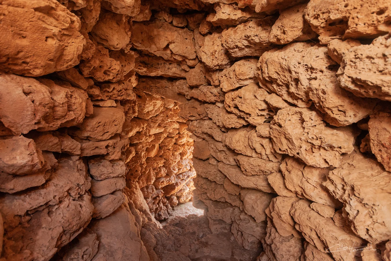

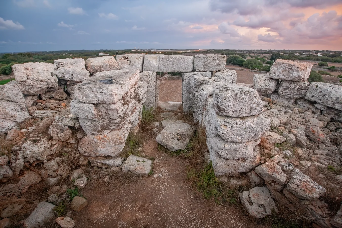
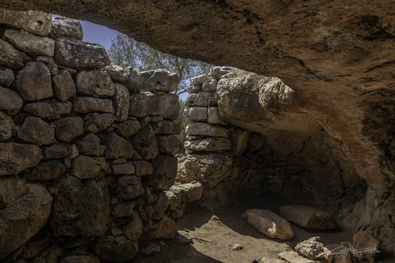
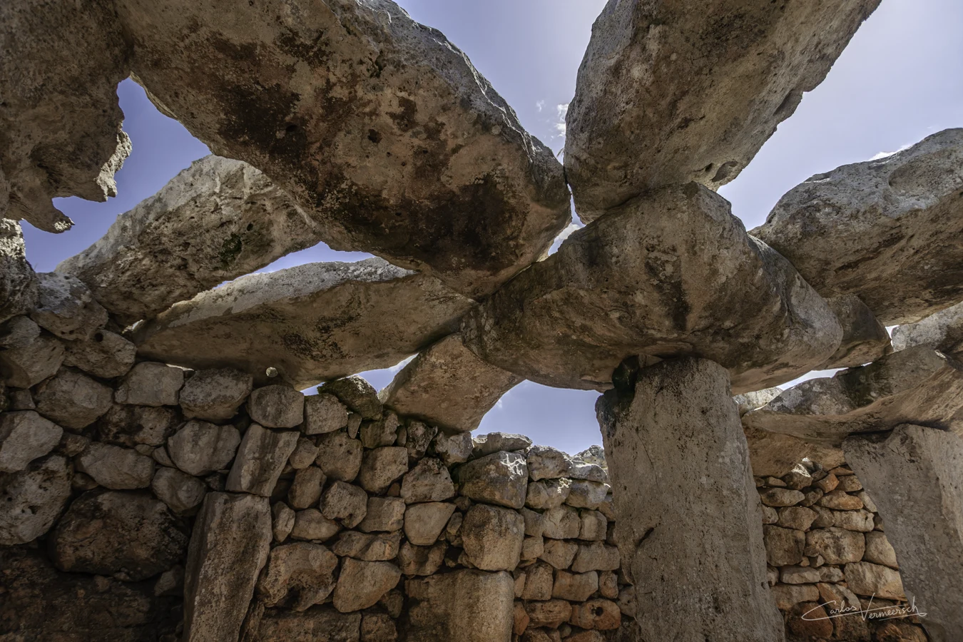
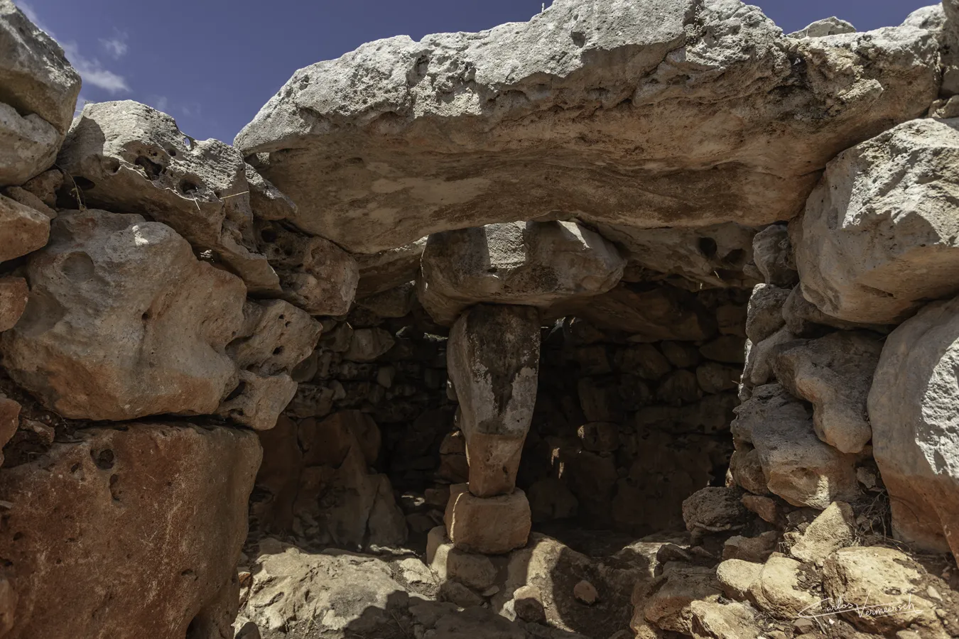
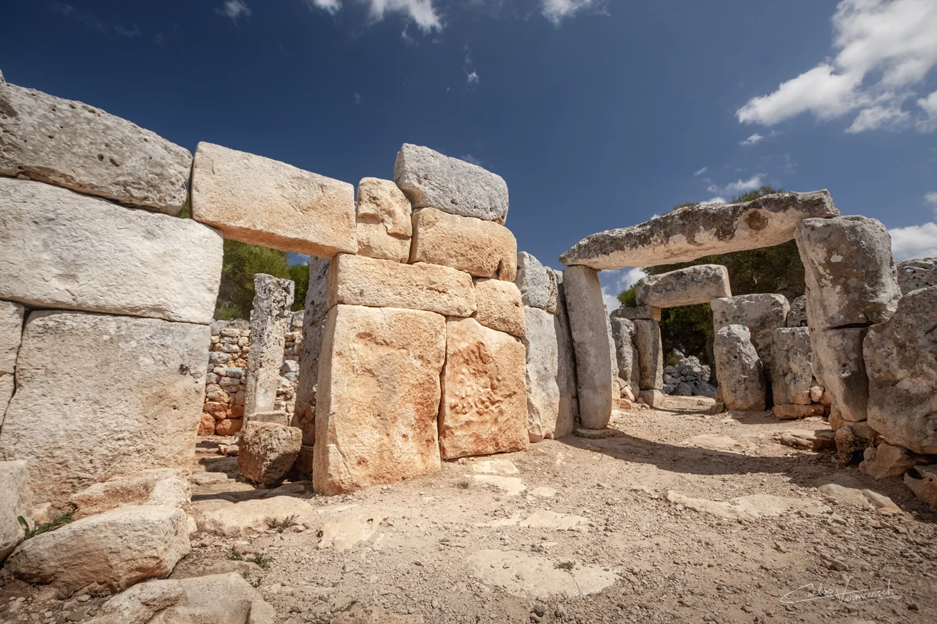
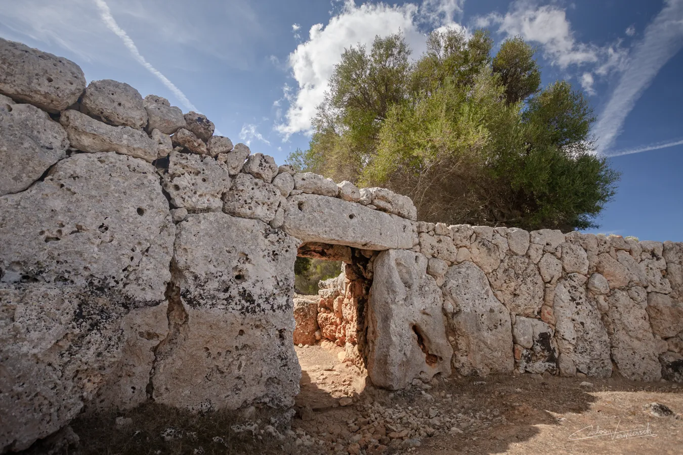
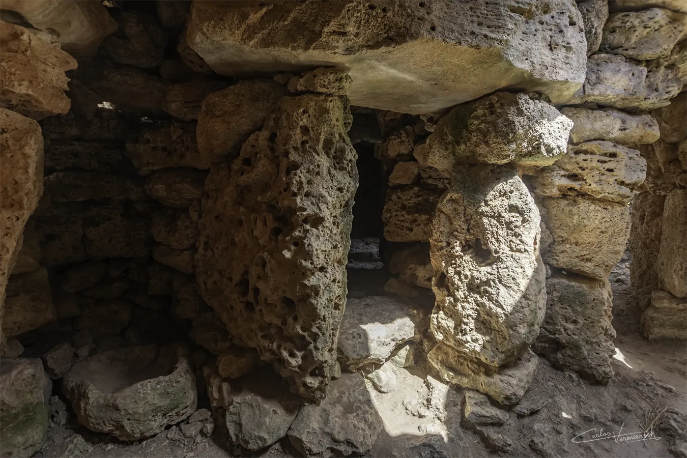
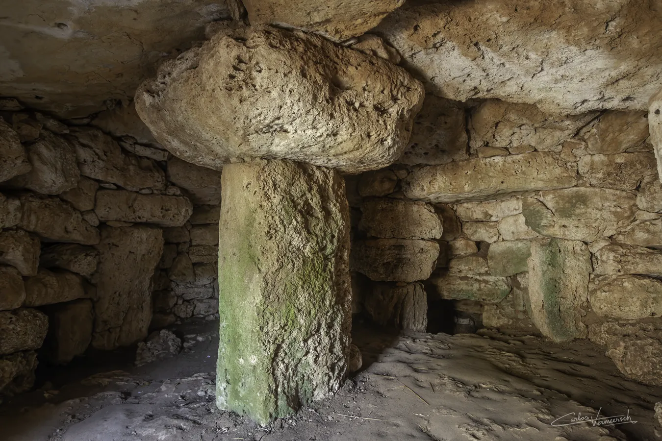
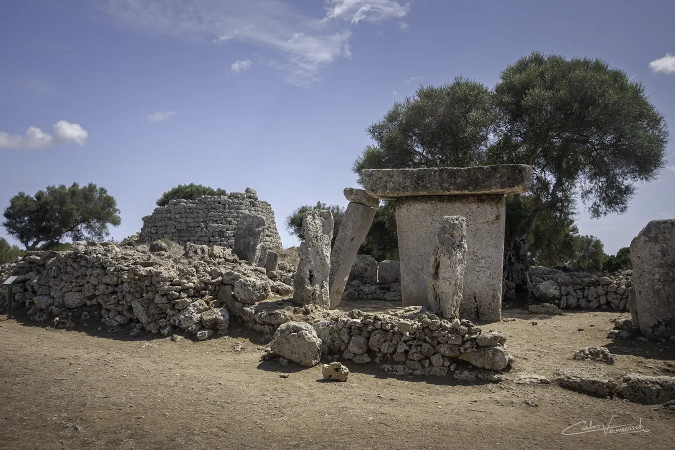
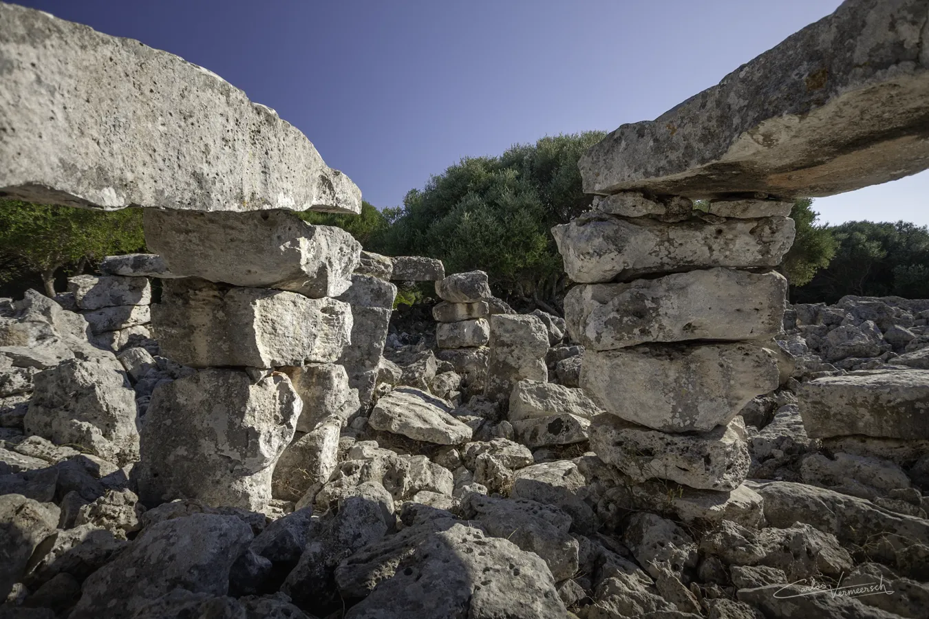
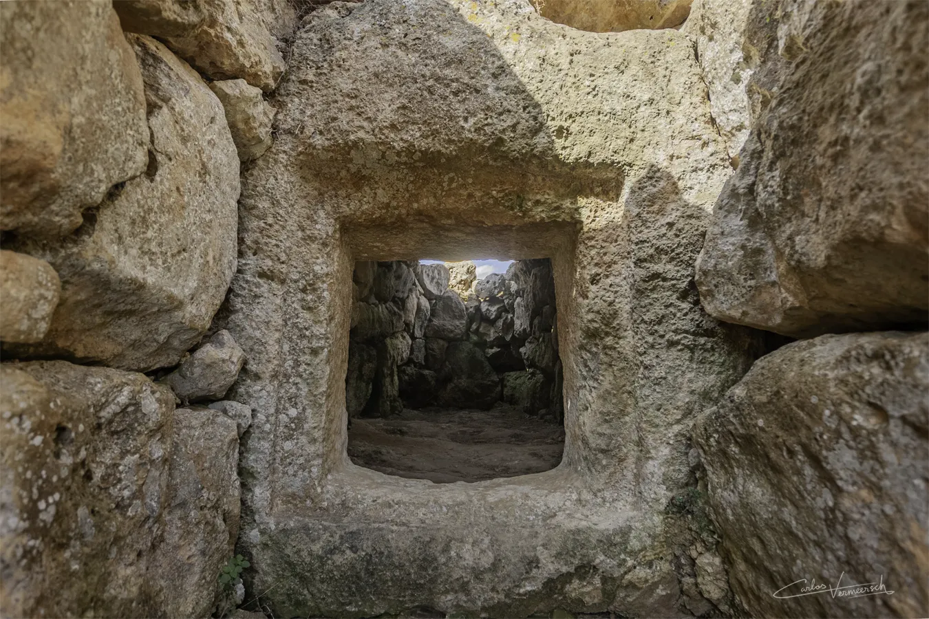
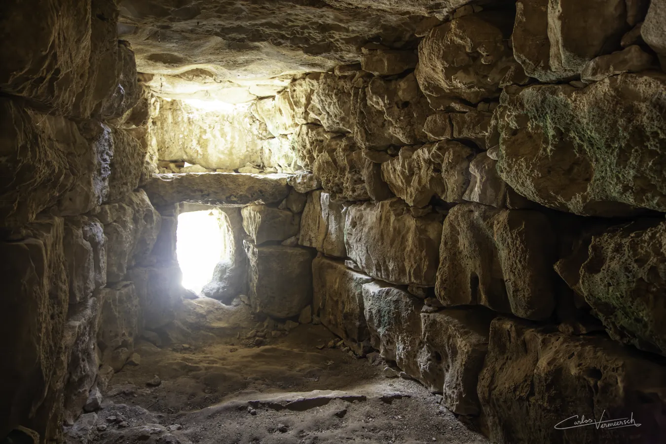
Amidst the waters of the western Mediterranean Sea lies a small, remote island that is an entire world of its own—full of wildlife, history, legends, mysteries and conflicts: Minorca. It is one of the four Balearic Islands, the others being Majorca, Ibiza and Formentera, along with many minor islands and islets close to the biggest islands, such as Cabrera, Dragonera and S’Espalmador.
Megalithic constructions of Minorca date back over 4 millennia into the past, and range from dolmens to the pre-Talaiotic, Talaiotic and post-Talaiotic cultures—times of which barely no written sources exist, and ruins are virtually the only testimony. During the Archaic Period, the Phoenicians that sailed near Minorca to reach their colonies could see bonfires shining from the top of the defensive towers, called talaiots, that littered the Minorcan landscape. Minorca is unique in its primeval quality, due to the tremendous amount of magnificent megalithic and cyclopean ruins, like navetas, taulas and talaiots, which always seem to blend in so harmoniously with its surroundings.
Minorca’s prehistory and proto-history developed uniformly with Majorca’s during the Chalcolithic (Copper Age) and the Early Bronze Age. During the end of the Middle Bronze Age, the two islands entered the Talaiotic Culture and, despite the many similarities, started diverging. Minorca has many monuments exclusive to the island, like the navetas, elliptic talaiots, circles (houses) and, of course, the enigmatic taulas; whereas Majorca has square talaiots.
It is estimated that the natives arrived sometime in the 3ʳᵈ millennium BC. These were people whose culture was developing during the transition from the Neolithic and the Copper Age and worked the ground. With their arrival, they introduced livestock like sheep, goats, cows and pigs. Initially they lived alongside of the endemic Balearic cave goat, Myotragus balearicus (5,3 Ma–0,005 Ma), which was driven to extinction soon after. In fact, it was more closely related to sheep than to goats, and one of its most remarkable traits is that the eyes were not directed towards the sides, as are those of nearly all herbivorous mammals, but towards the front like nearly all primates and carnivores, granting them stereoscopic vision, something it could afford due to the lack of predators.

Up until the 20th century, it was thought that the Talaiotic Culture rose from the interaction with peoples from the Eastern Mediterranean such as the Sea Peoples or the Nuragic Civilization from Sardinia, who built defensive towers that are very similar in appearance to talaiots. It was believed this process either occurred in the form of an invasion or as a peaceful assimilation.
However, archaeological evidence indicates that the Sardinian nuraghes were built around 3900 years ago, considerably earlier than talaiots that first appeared 3400 years ago, and were instead contemporary with Minorcan navetas, that were already being used 4000 years ago. Likewise, the crisis of the 13th century BC caused in the western Mediterranean by the Sea Peoples also predates the constructions of talaiots. In fact, the evolution from the pre-Talaiotic Culture to the Talaiotic Culture during the Bronze Age seems to have been a very gradual transition that lasted several centuries, caused by a local crisis on the archipelago.
Ancient accounts of the Balearic Islands
There are different traditions regarding their inhabitants. It was said that they went naked, or clothed only in sheep-skins and only naked during the heat of summer (Tzetzes, ad Lycophronem), until the Phoenicians clothed them with broad-bordered tunics—though this passage might also mean the Balearians invented the laticlave, and so it was understood by Eustathius, whose note is chiefly taken from Strabo.
ὅμως σφενδονῆται ἄριστοι λέγονται: καὶ τοῦτ᾽ ἤσκησαν, ὥς φασι, διαφερόντως ἐξ ὅτου Φοίνικες κατέσχον τὰς νήσους. οὗτοι δὲ καὶ ἐνδῦσαι λέγονται πρῶτοι τοὺς ἀνθρώπους χιτῶνας πλατυσήμους. Translation: However, they are said to be the best slingers: and this they practiced since the Phoenicians took possession of the islands. These same people (the Balearians?; the Phoenicians?) are also said to have been the first to clothe men (all men?; the men of the Baleares?) in broad tunics. — Strabo, Geographia, § 3.5.1
It is also said that they lived in hollow rocks and artificial caves; that they were remarkable for their love of women, and, when any were taken captive by pirates, they would give three or four men as the ransom for one woman; that they had no gold or silver coin, and forbade the importation of the precious metals (Diodorus 5.17).
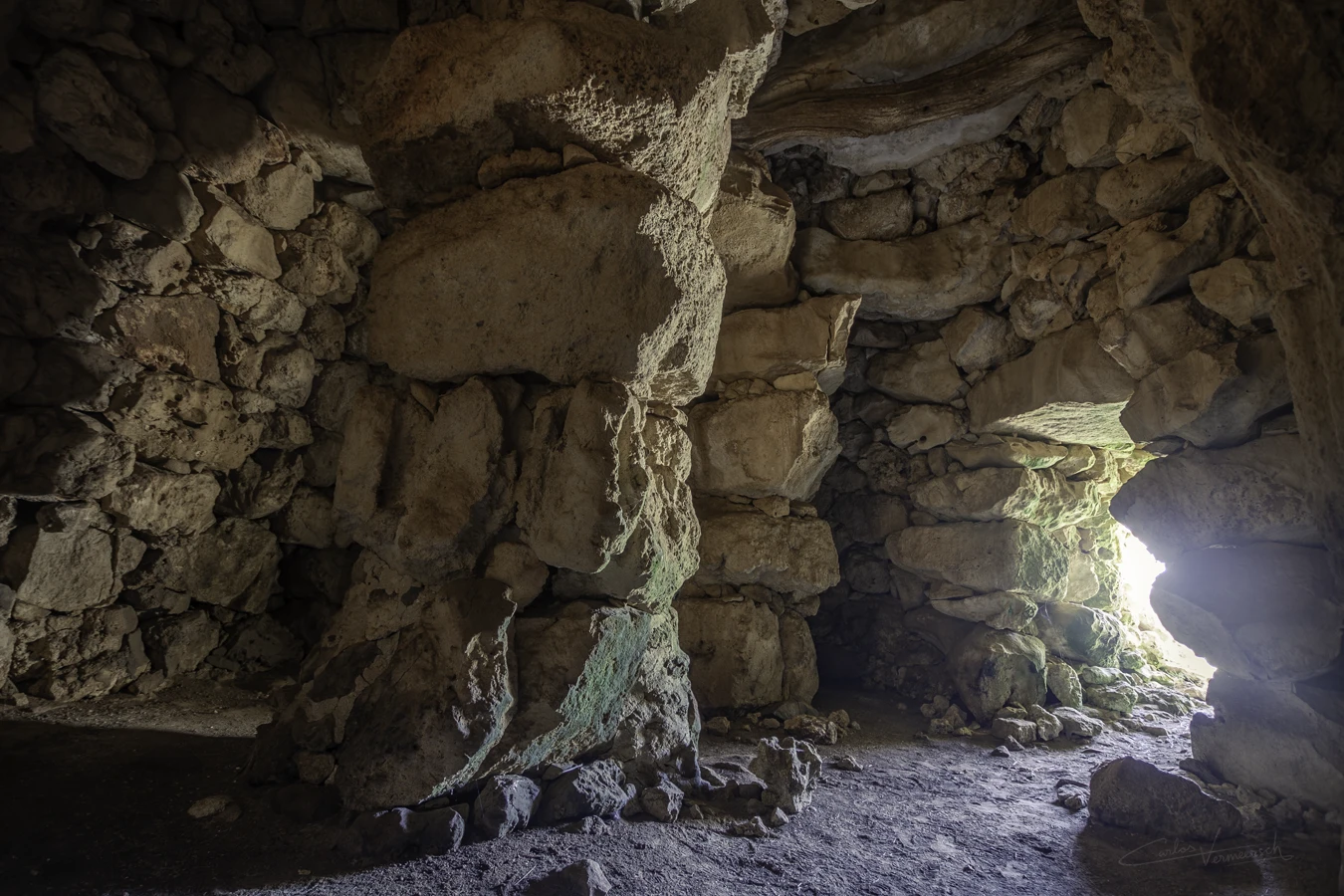
Diodorus Siculus told us about the dwellings of the Balearians, and about their habit of living in natural and artificial caves, such as House 1 at Torre d'en Galmés, as well as semi-subterraneous structures, such as the ones at Talatí de Dalt:
οἰκοῦσι δ᾽ ὑπὸ ταῖς κοιλάσι πέτραις, καὶ παρὰ τοὺς κρημνοὺς ὀρύγματα κατασκευάζοντες καὶ καθόλου πολλοὺς τόπους ὑπονόμους ποιοῦντες ἐν τούτοις βιοῦσιν, ἅμα τὴν ἐξ αὐτῶν σκέπην καὶ ἀσφάλειαν θηρώμενοι. Translation: They live beneath the hollowed-out rocks, and by constructing tunnels along the cliffs and generally making many places into underground passages, they dwell within them, seeking both shelter and safety from them. — Diodorus Siculus, § 5.17
Additionally, Diodorus describes the ancient Balearians raising a heap of stones over their dead, which according to John Armstrong might correspond to watch-mounts, the he called speculae and are today known as talaiots. I, however, believe Diodorus rather referred to navetas, an older structure that pre-dates talaiots, such as the pre-Talaiotic early navetas of Rafal Rubí, the pre-Talaiotic late navetas of Biniac-L'Argentina, or the Talaiotic late naveta of Es Tudons. Unlike talaiots, these are known to have been collective burial chambers.
ἴδιον δέ τι ποιοῦσι καὶ παντελῶς ἐξηλλαγμένον περὶ τὰς τῶν τετελευτηκότων ταφάς: συγκόψαντες γὰρ ξύλοις τὰ μέλη τοῦ σώματος εἰς ἀγγεῖον ἐμβάλλουσι καὶ λίθους δαψιλεῖς ἐπιτιθέασιν. Translation: They also have a peculiar and entirely different custom concerning the burial of the deceased: after cutting the limbs of the body with pieces of wood, they place them in a vessel and pile upon it a heap of stones. — Diodorus Siculus, § 5.18.1
The Balearians were mainly known for their skill as slingers, in which capacity they served as mercenaries, first under the Carthaginians and afterwards under the Romans. We know from classical authors that the Balearic slingers were much admired for their skills in the use of the sling and their bravery (Pliny 3, 5, 76). The Balearic slingers were held in high regard by Carthaginians and Romans and were heavily recruited in both their armies. They went into battle ungirt, with only a small buckler, and a javelin burnt at the end, and in some cases tipped with a small iron point; but their effective weapons were their slings, of which each man carried three, wound round his head (Strab. p. 168; Eustathius), or, as others tell us, one round the head, one round the body, and one in the hand. (Diodorus 5.18; Tzetzes ad Lycophronem). The three slings were of different lengths, for stones of different sizes; the largest they hurled with as much force as if it were flung from a catapult; and they seldom missed their mark. According to Strabo (III, 1-2), the Balearic slingers were the best among all other slingers and far superior to the men from Egio, Patras and Dimo. To this exercise they were trained from infancy, in order to earn their livelihood as mercenary soldiers. It is said that the mothers only allowed their children to eat bread when they had struck it off a post with the sling (Strabo p. 168; Diodorus 5.18; Flor. 3.8; Tzetzes ad Lycophronem).
The Balearic slingers are referenced in the writings of Strabo, Diodorus Siculus, Florus, Livy, Polybius, Vegetius and Zonaras. Virgil alludes to them in The Georgics, while Ovid includes them in Metamorphoses.
And their training in the use of slings used to be such, from childhood up, that they would not so much as give bread to their children unless they first hit it with the sling. — Strabo
Recruits are to be taught the art of throwing stones both with the hand and sling. The inhabitants of the Balearic Islands are said to have been the inventors of slings, and to have managed them with surprising dexterity, owing to the manner of bringing up their children. The children were not allowed to have their food by their mothers till they had first struck it with their sling. Soldiers, notwithstanding their defensive armor, are often more annoyed by the round stones from the sling than by all the arrows of the enemy. Stones kill without mangling the body, and the contusion is mortal without loss of blood. It is universally known the ancients employed slingers in all their engagements. There is the greater reason for instructing all troops, without exception, in this exercise, as the sling cannot be reckoned any incumbrance, and often is of the greatest service, especially when they are obliged to engage in stony places, to defend a mountain or an eminence, or to repulse an enemy at the attack of a castle or city. — Vegetius
ὁπλισμὸς δ᾽ ἐστὶν αὐτοῖς τρεῖς σφενδόναι, καὶ τούτων μίαν μὲν περὶ τὴν κεφαλὴν ἔχουσιν, ἄλλην δὲ περὶ τὴν γαστέρα, τρίτην δ᾽ ἐν ταῖς χερσί. κατὰ δὲ τὰς πολεμικὰς χρείας βάλλουσι λίθους πολὺ μείζους τῶν ἄλλων οὕτως εὐτόνως, ὥστε δοκεῖν τὸ βληθὲν ἀπό τινος καταπέλτου φέρεσθαι: διὸ καὶ κατὰ τὰς τειχομαχίας ἐν ταῖς προσβολαῖς τύπτοντες τοὺς ἐπὶ τῶν ἐπάλξεων ἐφεστῶτας κατατραυματίζουσιν, ἐν δὲ ταῖς παρατάξεσι τούς τε θυρεοὺς καὶ τὰ κράνη καὶ πᾶν σκεπαστήριον ὅπλον συντρίβουσι. κατὰ δὲ τὴν εὐστοχίαν οὕτως ἀκριβεῖς εἰσιν, ὥστε κατὰ τὸ πλεῖστον μὴ ἁμαρτάνειν τοῦ προκειμένου σκοποῦ. αἴτιαι δὲ τούτων αἱ συνεχεῖς ἐκ παίδων μελέται, καθ᾽ ἃς ὑπὸ τῶν μητέρων ἀναγκάζονται παῖδες ὄντες συνεχῶς σφενδονᾶν: προκειμένου γὰρ σκοποῦ κατά τι ξύλον ἠρτημένου ἄρτου, οὐ πρότερον δίδοται τῷ μελετῶντι φαγεῖν, ἕως ἂν τυχὼν τοῦ ἄρτου συγχωρούμενον λάβῃ παρὰ τῆς μητρὸς καταφαγεῖν τοῦτον. Translation: As for their weaponry, they have three slings, one of which they carry around their head, another around their waist, and the third in their hands. In battle, they hurl stones that are much larger than those used by others with such force that the projectile appears to be launched from a catapult. Thus, during sieges, they strike and wound those standing on the battlements, and in regular battles, they shatter shields, helmets, and any protective armor. In terms of accuracy, they are so precise that they rarely miss their intended target. The reason for this is their continuous training from childhood, as their mothers compel them to practice slinging. A loaf of bread is hung on a wooden target, and the child is not allowed to eat until they successfully strike and bring down the bread to be granted permission to consume it. — Diodorus Siculus, § 5.18.3
A dextro interim cornu funditores sagittariique concita tela in elephantos frequenter iniciunt. Quo facto bestiae stridore fundarum, lapidum plumbique + itata + perterritae sese convertere et suos post se frequentes stipatosque proterere et in portas valli semifactas ruere contendunt. Translation: Meanwhile on the right wing the slingers and archers in crowds launched rapid volleys of missiles against the elephants. Whereupon the beasts, terrified by the whizzing sound of the slings and by the stones and leaden bullets launched against them, speedily wheeled round, trampled under foot the massed and serried ranks of their own supporting troops behind them, and rushed towards the half-completed gates of the rampart. — Anonymous, Caesar's African War, § 83 - 46 BC
The Son of Jove, astonished, while he wheeled on balanced pinions through the yielding air, burned hot; as oft from Balearic sling the leaden missile, hurled with sudden force, burns in a glowing heat beneath the clouds. — Ovid, Metamorphoses, 2.708 - ca. 8 AD
Contrary to popular belief, slings were extremely effective. The sling is a challenging weapon to master in terms of accuracy, consistency, and power. However, this does not imply that the sling is inherently inaccurate. Numerous ancient sources attest to the remarkable precision of skilled slingers. Yet, attaining such proficiency required extensive training and is more demanding than mastering archery. For this reason, the use of the sling as a weapon was restricted to those societies that were specialised in its use—i.e. Balearians, Rhodans, etc.—who, in turn, were hired as mercenaries. While a longbow had an effectiveness up to 100 meters, the Balearic slingers launched projectiles to more than 200 meters far. On the legions battle order they were in charged to start the hostilities from the flanks even before than the longbow men could do it. Moreover, the first known mention an armoured ship in history was due to Balearic slingers. On 123 BC, Quintus Caecillius Metellus begun the conquest of the island of Majorca. According to Livy (History of Rome, § 28.37), the slingers were able to repell the Carthaginian ships from the coast shooting to the waterline of the ships' hulls with lead bullets. Aware of the islander's formidable skill with slings—proven during the Punic Wars—Quintus had his ships and soldiers shielded with hides during disembarkation. Only two years later Majorca was finally conquered.
According to Silius Italicus, the natives of the islands are descendants of the slingers from Rhodes that fled after the Trojan war, probably because Rhodans were renowned slingers as well.
The Rhodians, like the Baleares, were celebrated slingers. — Strabo, xiv. p.654
Jam cui Tlepolemus sator, et cui Lindus origo, Funda bella ferens Balearis et alite plumbo. Translation: Now he, whose ancestor was Tlepolemus and whose origin was from Lindus, the Balearic slinger waging war, bearing his sling and winged lead. — Silius Italicus 3.364, 365
The name for the Balearic Islands was originally meant to designate only Majorca and Minorca, and was synonymous with the Gymnesians—the Balearic Islands generally being the Roman designation and the Gymnesians the Greek counterpart. Ibiza and Formentera, on the other hand, were called the Pityuses.
The Greeks usually adopted local names into their own language, but they primarily called the westernmost islands of the archipelago Γυμνησίαι (Gymnesíai). Lycophron explained Minorca and Majorca were called Γυμνησίαι (Gymnesíai), from the Greek γυμνός (gymnós, “naked”), because its inhabitants were often naked, probably because of the mostly balmy year-round climate. This led Lycophron to claim that certain Boeotians were cast naked on the islands, whence the name Γυμνησίαι (Gymnesíai).
διὰ τὸ γυμνοὺς καὶ ἀχλαίνους, ἐκεῖ ἐχενεχθῆναι Translation: Because they were naked and without cloaks, they were carried away there. — Lycophron
οἱ δ᾽ ἀμφικλύστους χοιράδας Γυμνησίας σισυρνοδῦται καρκίνοι πεπλωκότες ἄχλαινον ἀμπρεύσουσι νήλιποι βίον, τριπλαῖς δικώλοις σφενδόναις ὡπλισμένοι. ὧν αἱ τεκοῦσαι τὴν ἑκηβόλον τέχνην ἄδορπα παιδεύσουσι νηπίους γονάς. οὐ γάρ τις αὐτῶν ψίσεται πύρνον γνάθῳ, πρὶν ἂν κρατήσῃ ναστὸν εὐστόχῳ λίθῳ ὑπὲρ τράφηκος σῆμα κείμενον σκοποῦ. Translation: And others shall sail to the sea-washed Gymnesian rocks—crab-like, clad in skins—where cloakless and unshod they shall drag out their lives, armed with three two-membered slings. Their mothers shall teach the far-shooting art to their young offspring by supperless discipline. For none of them shall chew bread with his jaws, until with well-aimed stone he shall have won the cake set as a mark above the board. — Lycophron of Chalcis, 270 –260 BC, Alexandria, 633-641
However, Strabo thought that Gymnesíai probably referred to the light equipment used by the Balearic troops, known in Greek as γυμνῆται (gymnē̂tai) (Strab. xiv. p.654; Pliny the Elder). The first known mention of the gymnetes is found in the Ora Maritima (Sea Coasts) by Avienus around 500 BC, a work which consists of a compilation of older writings. Lycophron’s story must have been invented to account for the primary Greek name of the islands, as a case of folk etymology.
Alternatively, in Greek they were also called, to a lesser extent, Βαλλιαρεῖς (Balliareĩs) by Diodorus Siculus and Eustathius (ad Dionysus Periegetes), Βαλιαρεῖς (Baliareĩs) and Βαλιαρίδες (Baliarídes) by Stephanus Byzantinus, Βαλεαρίδες (Balearídes) by Strabo, Βαλλιαρίδες (Balliarídes) by Ptolemy, and Βαλεαρίαι (Balearíai) by Agathemerus. The Romans called Majorca and Minorca Baleares, as referred to by Pliny. The forms with i are generally used by the Greeks, those with e by the Romans, but Baliares also occurs on Latin inscriptions.
Nearly all the ancient writers used the term to include merely the two large islands called the Greater, Balearis Major (ἡ μείζων), and the Lesser, Balearis Minor (ἡ ἐλάττων), or, as they were called in the Byzantine period, Majorica and Minorica (Μαιόρικά τε καὶ Μινόρικα: Procopius), whence the common modern names, Majorca and Minorca, or in Spanish Mallorca and Menorca. The greater island was also known as Columba (Antonine Itinerary, p. 511) and the lesser, Nura (Antonine Itinerary, p. 512), taken probably from the Phoenician word nūr (𐤍𐤅𐤓, nwr), meaning "fire", possibly because when their ships sailed near the island, they could see bonfires shine from the top of the talaiots.
The oldest known mention of Majorca and Minorca is by the geographer Hecataeus of Miletus around 500 BC, as recounted by Stephanus Byzantinus in the 6ᵗʰ century AD in his work Ethnica (§ M450.17 and § K386.12). Hecataeus named them Κρομύουσα (Kromýousa), derived from κρόμυον (krómyon) meaning "onion", and Μήλουσα (Mḗlousa), derived from μῆλον (mē̂lon) meaning "apple," but most likely from the plural form μῆλᾰ (mē̂lă) in which it has the figurative meaning of "livestock," the greatest wealth of Minorca. Another theory claims that the latter is derived from Μέλουσα (Mélousa), the a present participle of the verb μέλω (mélō), which intransitively means "to be the object of care or concern." Μέλουσα νῆσος (Mélousa nē̂sos) could be translated as "cared-for island." This interpretation is confirmed by the scholium on the text of the Odyssey, 40, 70, which refers to the ship Argos that Jason traveled on, stating: "Argos was the most cared-for (or the one that was taken the most care of)." However, this would only be true with the premise that the island's name would be written with the letter ε (epsilon), and not η (ēta) which is how Stephanus Byzantinus has spelled it. According to a theory, the toponyms ending in -ous(s)a indicate the maritime route of the ancient Greeks from Chalcis and Rhodes (9ᵗʰ–8tᵗʰ century BC) that connected Asia Minor with Spain through the islands—cf. Δρυμούσσα (Drymoússa) in the Gulf of İzmir; Δονούσα (Donoúsa); Σχοινούσσα (Schoinoússa); Οφιούσσα (Ophioússa), an old name for Rhodes and that of another in the in the Cyclades; Πιτυοῦσσαι (Pityoūssai), modern Ibiza and Formentera; and Οφιούσα (Ophioúsa), modern Formentera. However, a city located at the delta of the Dniester, in the region of Τύρας (Týras), also had the same ending, and even the same name as some of these islands: the city of Οφιούσα (Ophioúsa). According to Pliny (Natural History, III, 77-78), there were five important settlements on Majorca—Palma, Pollentia, Guium, Tucis and Bocchor—and three in Minorca—Iamo/Iamna, Sanisera and Mago.
As for the small island of Cabrera, located south of Majorca, it corresponds to the Capraria of Pliny (Historia Naturalis, § 3.78 [11]) who describes it as having a treacherous coast notorious for its numerous shipwrecks (insidiosa naufragiis). Pliny likewise names the islets opposite to Palma as Marmariae, Tiquadra, and parva Hannibalis.

τούτων δ᾽ ἡ μείζων μεγίστη πασῶν ἐστι μετὰ τὰς ἑπτὰ νήσους, Σικελίαν, Σαρδώ, Κύπρον, Κρήτην, Εὔβοιαν, Κύρνον, Λέσβον, ἀπέχει δὲ τῆς Ἰβηρίας πλοῦν ἡμερήσιον: ἡ δ᾽ ἐλάττων κέκλιται μὲν πρὸς τὴν ἕω, τρέφει δὲ κτήνη πολλὰ καὶ παντοδαπά, μάλιστα δ᾽ ἡμιόνους, μεγάλους μὲν τοῖς ἀναστήμασιν, ὑπεράγοντας δὲ ταῖς ῥώμαις. ἀμφότεραι δ᾽ αἱ νῆσοι χώραν ἔχουσιν ἀγαθὴν καρποφόρον καὶ πλῆθος τῶν κατοικούντων ὑπὲρ τοὺς τρισμυρίους. Translation: Of these islands, the larger one is the greatest of all after the seven islands—Sicily, Sardinia, Cyprus, Crete, Euboea, Cyrnus (Corsica), and Lesbos. It lies a day's sail from Iberia. The smaller island is inclined toward the east and supports a great variety of livestock, especially mules, which are both large in stature and surpass others in strength. Both islands possess fertile and productive land, and their population exceeds thirty thousand inhabitants. — Diodorus Siculus, 5.17
Most of the Greek and Roman writers thought that the name of the people and the islands was derived from βάλλειν (bállein, "to throw"), based on their sill as slingers. However, Strabo thought the name was of Phoenician origin, claiming that it was the Phoenician equivalent for lightly armoured soldiers, which, as specified earlier, the ancient Greeks called γυμνῆτας (gymnē̂tas). His explanation is evidently wrong, but the root bal indeed suggests a Phoenician or Punic origin, and the resemblance to the Greek root βαλ (bal) of the verb βάλλειν (bállein), coupled with the occupation of the people, would be quite a sufficient foundation for the usual Greek practice of assimilating the name to their own language through folk etymology.
ἦσαν δ᾽ οἱ διαβάντες εἰς τὴν Λιβύην Θερσῖται, Μαστιανοί, πρὸς δὲ τούτοις Ὀρῆτες Ἴβηρες, Ὀλκάδες, οἱ δὲ σύμπαντες ἀπὸ τούτων τῶν ἐθνῶν ἱππεῖς μὲν χίλιοι διακόσιοι, πεζοὶ δὲ μύριοι τρισχίλιοι ὀκτακόσιοι πεντήκοντα, πρὸς δὲ τούτοις Βαλιαρεῖς ὀκτακόσιοι ἑβδομήκοντα, οὓς κυρίως μὲν καλοῦσι σφενδονήτας, ἀπὸ δὲ τῆς χρείας ταύτης συνωνύμως καὶ τὸ ἔθνος αὐτῶν προσαγορεύουσι καὶ τὴν νῆσον. Translation: The troops who crossed to Libya were supplied by the Thersitae, Mastiani, Iberian Oretes and Olcades, and numbered twelve hundred horse and thirteen thousand eight hundred and seventy Balearians, a popular appellation, derived from ballein, “to throw,” and meaning slingers, given to them owing to their skill with this weapon and extended to their nation and islands. — Polybius, Historiae, § 3.33.9–3.33.11
Likewise, Isidore of Seville—the Hispano-Roman scholar, theologian, and Archbishop of Seville during the Visigothic Kingdom of Toledo (also known as the Regnum Spaniae)—derives the name from Greek in his Etymologiae. He maintains the distinction between the Balearic and Pityusic islands but refers only to Minorca as the Gymnesian island, while assigning an alternative name to Majorca. As with earlier scholars, he describes them as "islands of Spain," despite the fact that the Balearic and Pityusic islands were, at least nominally, still part of the Eastern Roman Empire at the time.
Ebosus insula Hispaniae dicta, quod a Zanio non procul sit, quasi ebozos. Nam LXX stadiis ab ea distat, cujus terram serpentes fugiunt. Huic contraria est Colubraria, quae referta est anguibus. Baleares insulae Hispaniae, duae sunt, Aphrosiade et Gymnasie, et major et minor. Unde et eas vulgus majoricam et minoricam nuncupant. 182 In iis primum insulis inventa est funda, qua lapides emittuntur, unde et Baleares dictae: βάλλειν enim Graece mittere dicitur; unde et ballista, quasi missa et fundibalum. Virgilius: Balearis verbere fundae. Translation: Ebosus, an island of Hispania, is so named because it is not far from Zanium (Denia), as if derived from 'ebozos'. It is seventy stadia away from it, and snakes flee from its soil. Opposite to it is Colubraria, which is filled with serpents. The Balearic Islands of Hispania are two: Aphrosiade and Gymnasie, the larger and the smaller. Hence, the common people call them Majorica and Minorica. In these islands, the sling was first invented, by which stones are hurled; thus, they are called Balearic: for βάλλειν in Greek means 'to throw'; from which also comes 'ballista', as if meaning 'missile' and 'fundibalum'. As Virgil says of them (Geo. 1.309): 'By the lash of the Balearic sling.' — Isidorus Hispalensis, Etymologiae, Liber XIV, De Terra et Partibus, Caput VI De insulis, § 43
However, it can be inferred that the name of the islands did not have its origin in Greek, since the most prevalent name of the islands in Greek is not Βαλιαρεῖς (Baliareĩs) or similar forms, but Γυμνησίαι (Gymnesíai).
ἄλλαι δ᾽ ὑπάρχουσι νῆσοι κατ᾽ ἀντικρὺ τῆς Ἰβηρίας, ὑπὸ μὲν τῶν Ἑλλήνων ὀνομαζόμεναι Γυμνήσιαι διὰ τὸ τοὺς ἐνοικοῦντας γυμνοὺς τῆς ἐσθῆτος βιοῦν κατὰ τὴν τοῦ θέρους ὥραν, ὑπὸ δὲ τῶν ἐγχωρίων καὶ τῶν Ῥωμαίων προσαγορεύονται Βαλιαρίδες ἀπὸ τοῦ βάλλειν ταῖς σφενδόναις λίθους μεγάλους κάλλιστα τῶν ἁπάντων ἀνθρώπων. Translation: There are other islands lying opposite Iberia, called Gymnesiae by the Greeks because the inhabitants live without clothing during the summer season; but they are called Balearides by the natives and the Romans, from the fact that they hurl large stones with slings more skillfully than all other men. — Diodorus Siculus, 5.17
Των δε προκειμενων νησων της Ἰβηριας τας μεν Πιτυουσσας δυο καιτας Γυμνησιας δυο (καλουσι και Βαλιαριδας) προκεισθαι συμβαινει της μεταξυ Ταρρακωνος και Σουκρωνος παραλιας, ἐφ΄ ης ἱδρυται το Σαγουντον. Translation: Of the islands that lie in front of Iberia, the two Pityuses and the two Gymnesians (also called Balearides) are located in front of the coast between Tarraco and Sucro, where Sagunto lies. — Strabo, Geographica - 65 BC–20 AD
Baliares funda bellicosas Graeci Gymnasias dixere. Translation: The Baleares, so formidable in war with their slingers, have received from the Greeks the name of Gymnasiae. — Pliny, Historia Naturalis, § 3.77
In fact, the name seems it was given by the Carthaginians and later used by the Romans and eventually the Greeks, deriving from the Punic baʿlē yaroh (𐤁𐤏𐤋𐤄 𐤉𐤓𐤄 bʿlh yrh). The noun baʿlē is the construct plural (to indicate association with the following noun) of "lord," whereas the verb yaroh means "to shoot (a projectile)" (cf. Hebrew ירה). Therefore, the meaning of the phrase would be "the masters of shooting," referring to its celebrated slingers.
As mentioned earlier, the islands of Ibiza and Formentera were known as Πιτυοῦσσαι (Pityoûssai) by Greeks, deriving from the Greek term πίτῠς (pítys, “pine tree”), as the islands are indeed covered in pine trees as noted by Pliny:
Insulae per haec maria primae omnium Pityussae Graecis dictae a frutice pineo. Translation: The first islands that we meet with in all these seas are the two to which the Greeks have given the name of Pityussae, from the pine-tree, which they produce. — Pliny, Historia Naturalis, § 3.76 [11]
As for the Phoenicians, they called the two islands 𐤀𐤉𐤁𐤔𐤌 (ʾybšm, ībošim, "islands of Beš"). This etymology is endorsed by coinage from the city of ʾĪbošim, depicting the god Bes, the symbol of the island. This may have been influenced by Phoenician berōs, meaning "pines", with the meaning of "islands of fragrance." In 654 BC, the Phoenicians founded a city with the same name on the larger island, later adapted to Greek as Εβυσσος (Ptolemy) and to Latin as Ebusus (Pliny), corresponding to modern Ibiza. This city became the centre of the western Mediterranean trade due to its privileged strategic position. The smaller island was called Οφιούσα (Ophioúsa), derived from ὄφῐς (óphĭs, "snake"), and which the Romans translated to Latin as Colubraria, from coluber, meaning snake as well. Though Pliny says that during his lifetime, both islands were known as Ebusus:
nunc Ebusus vocatur utraque, civitate foederata, angusto freto interfluente. Now both are called Ebusus, with a federated city, and a narrow strait flowing between. — Pliny, Historia Naturalis, 3.11
The islands were known in antiquity to not have any "harmful animals." Though one of the islands bore a name meaning "snake island," and Pliny explained the reason behind the naming of the island:
Ebusi terra serpentes fugat, Colubrariae parit, ideo infesta omnibus nisi Ebusitanam terram inferentibus; Graeci Ophiussam dixere. nec cuniculos Ebusus gignit, populantes Baliarium messes. Translation: The earth of Ebusus has the effect of driving away serpents, while that of Colubraria produces them; hence the latter spot is dangerous to all persons who have not brought with them some of the earth of Ebusus. The Greeks have given it the name of Ophiusa. Ebusus too produces no rabbits to destroy the harvests of the Baleares. — Pliny, Historia Naturalis, § 3.78 [11]
Strabo gives a more in-depth description of the lack of any harmful animals on the islands:
In addition to the fertility of the land, another favorable circumstance is that no harmful animal is easily found there. It is even said that rabbits are not native to the area; rather, a male and female were brought there by someone from the mainland. These rabbits multiplied to such an extent that their burrows undermined houses and trees. As a result, the inhabitants were compelled to seek assistance from the Romans. — Strabo

Dolmen Culture
(2500-2000 BC)
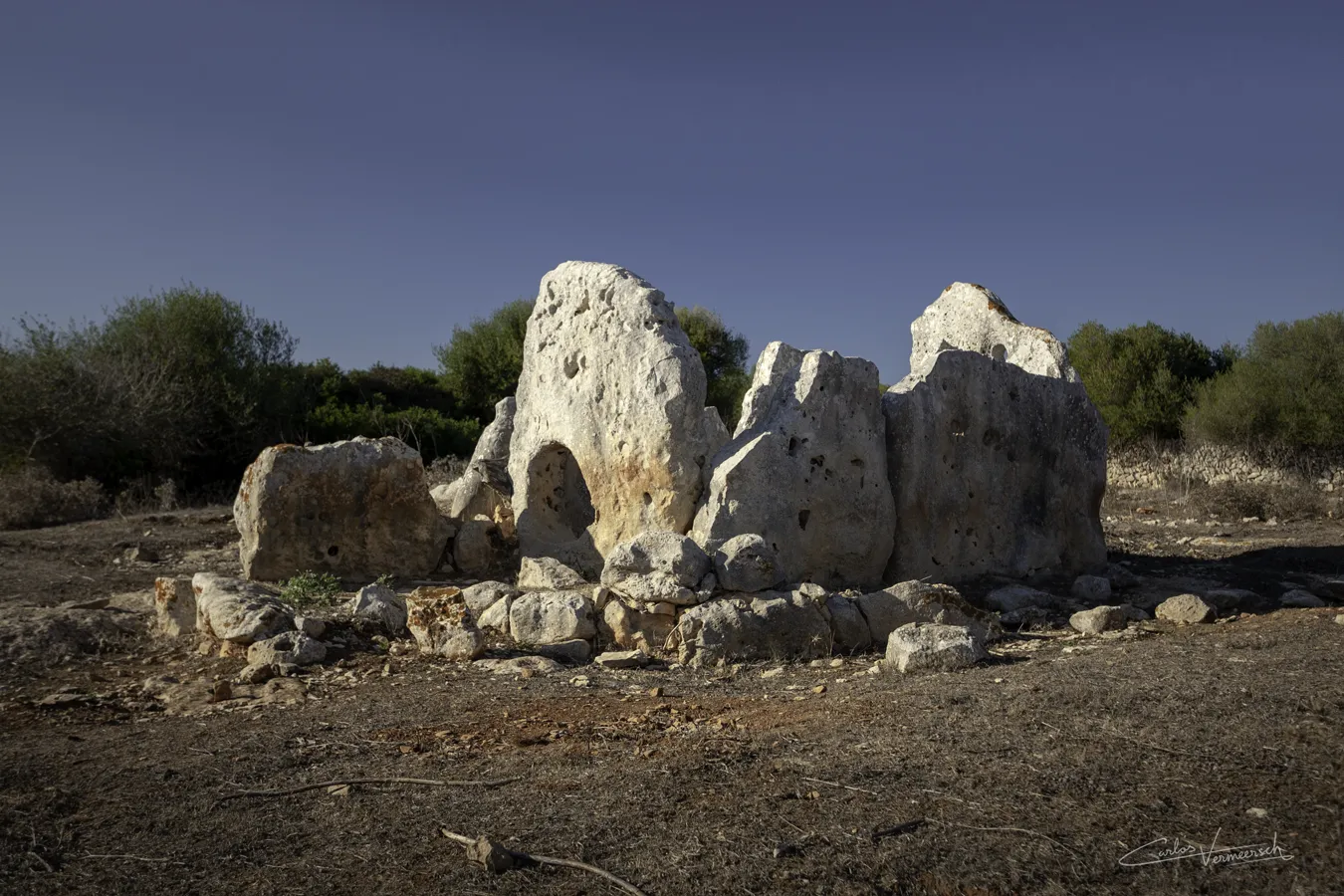
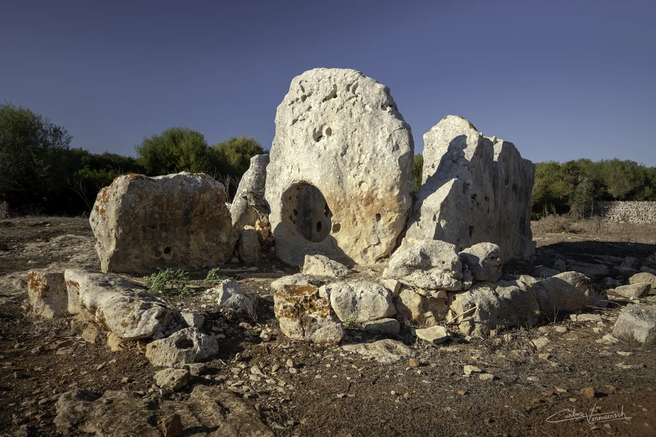
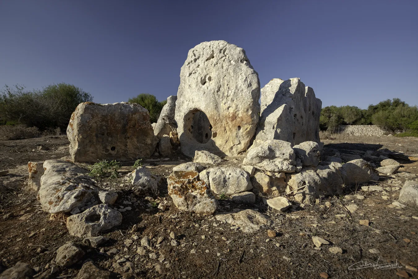
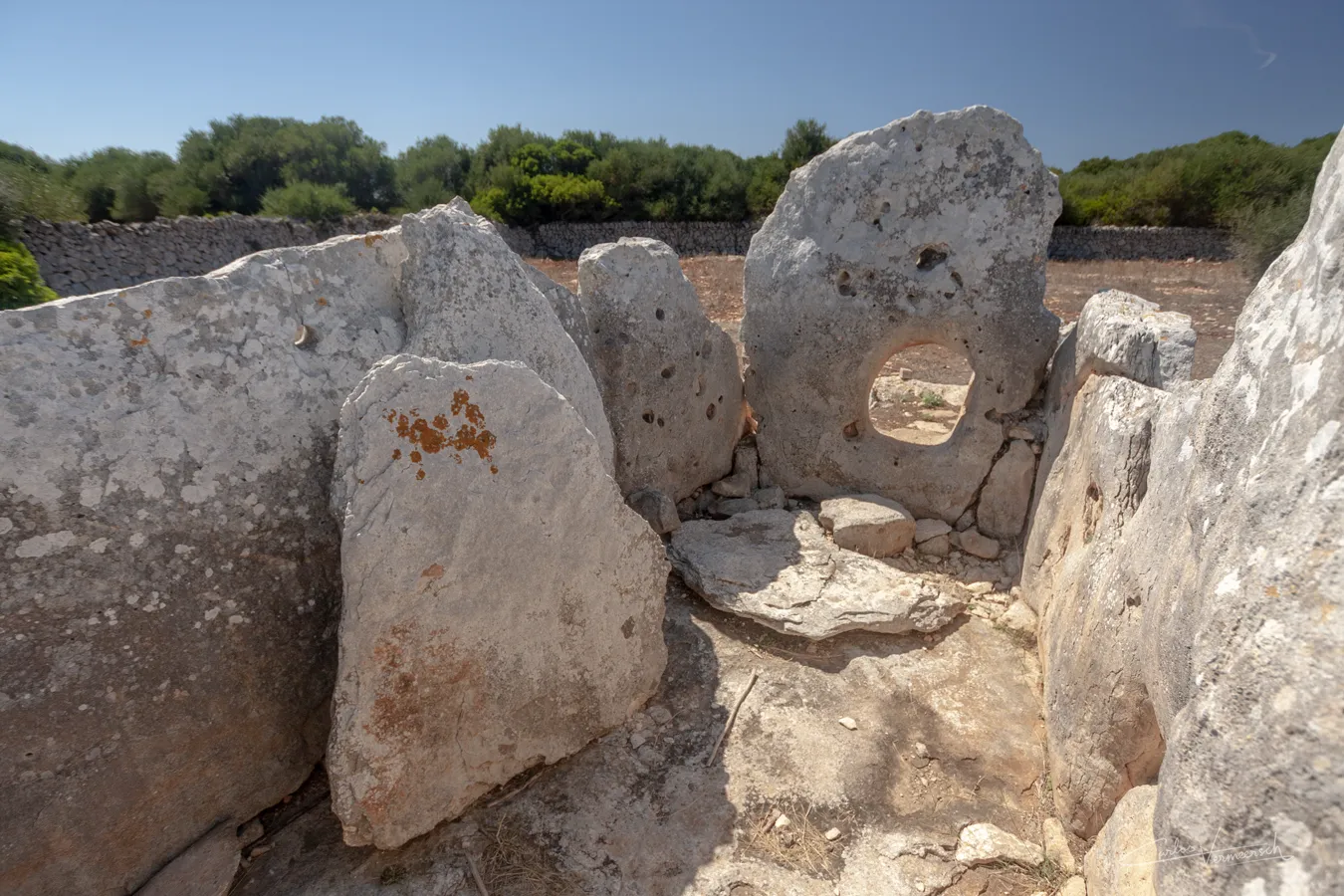
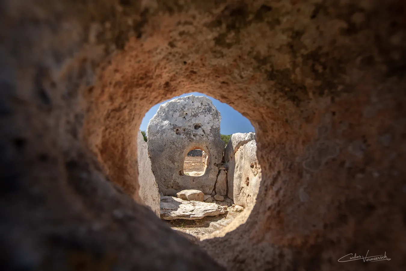
During the 3rd millennium BC, the first megalithic dolmens appeared. These funerary monuments were very similar to those of southern France and northeastern Spain. It is not known whether these structures were built by newly arrived peoples. Due to the scarcity of copper deposits on the islands for the metal’s extraction, contact with the exterior was necessary, so ties with the continent were apparently never severed.
Notable structures
The oldest structures of Minorca are dolmens. These are single-chamber tombs, consisting of two ore more orthostats supporting a horizontal capstone. They have corridors that lead to a perforated slab at the entrance. They were originally covered with earth or smaller stones to form a tumulus, but this covering is almost always weathered away, leaving only the stone skeleton of the burial mount. A great example is Ses Roques Llises.
Sites
Pre-Talaiotic Culture
(2000—1400 BC)
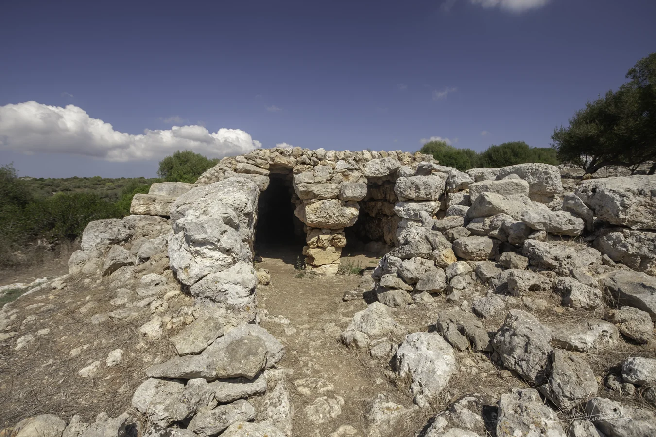
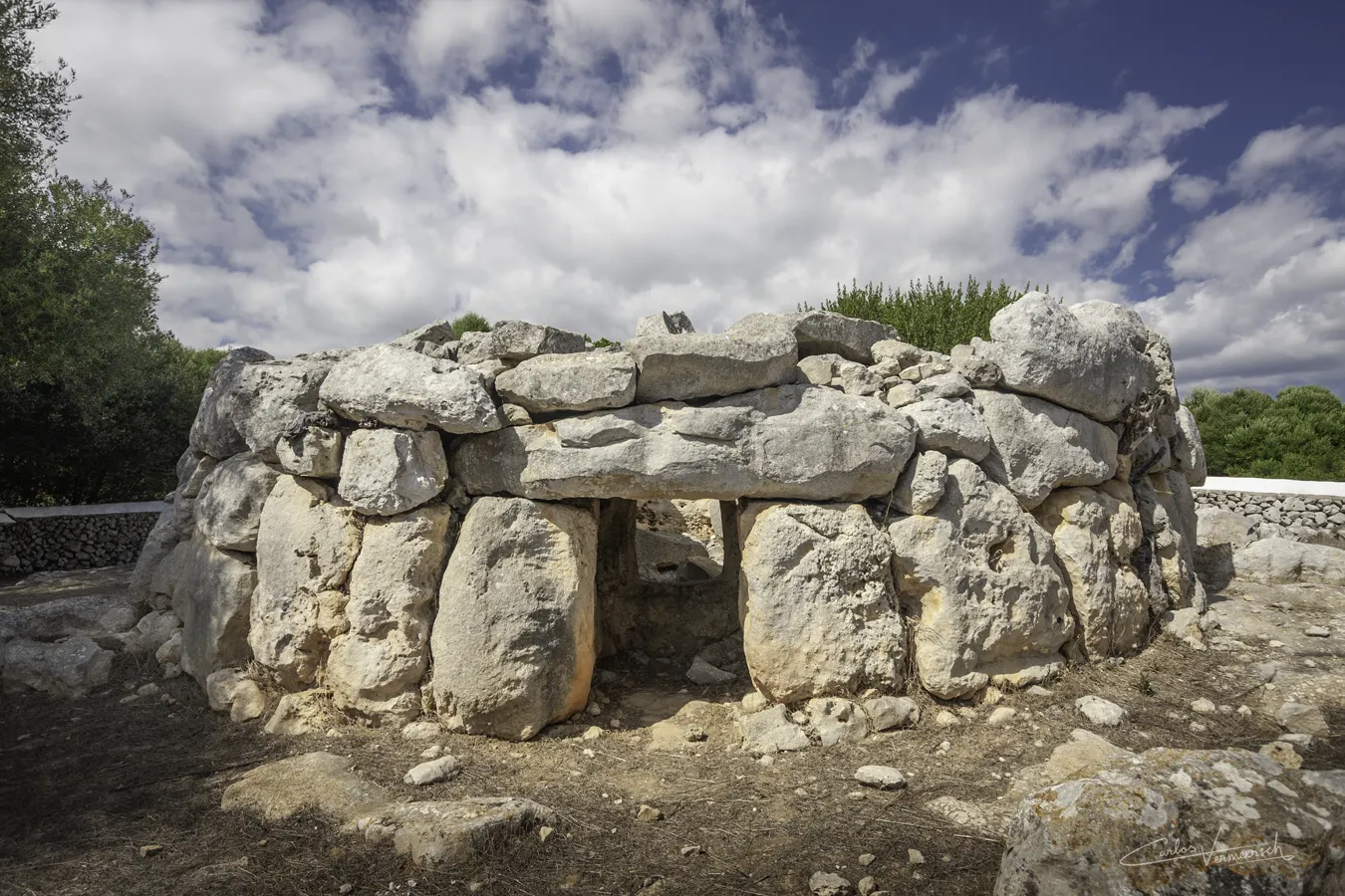
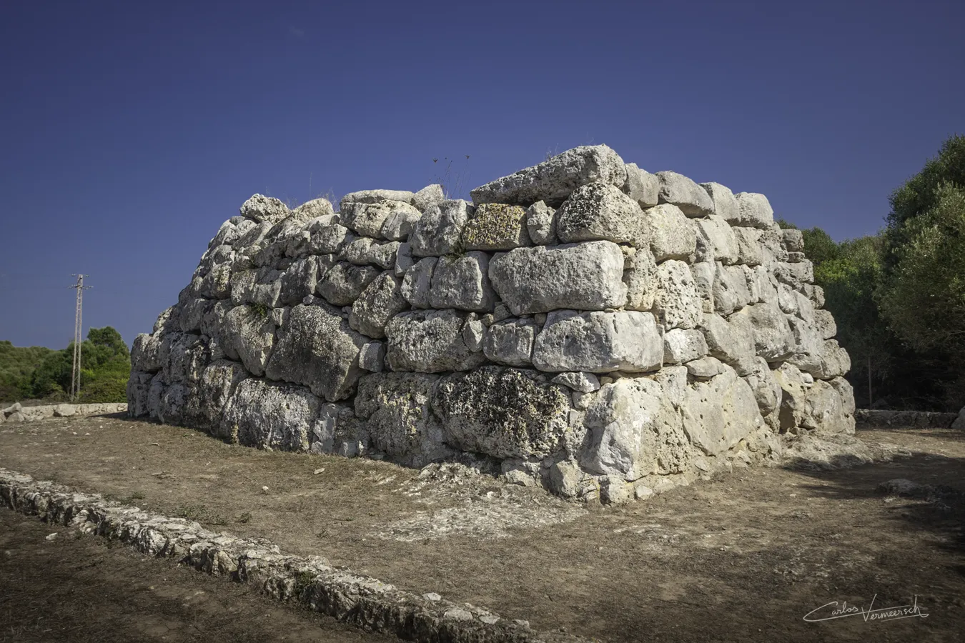
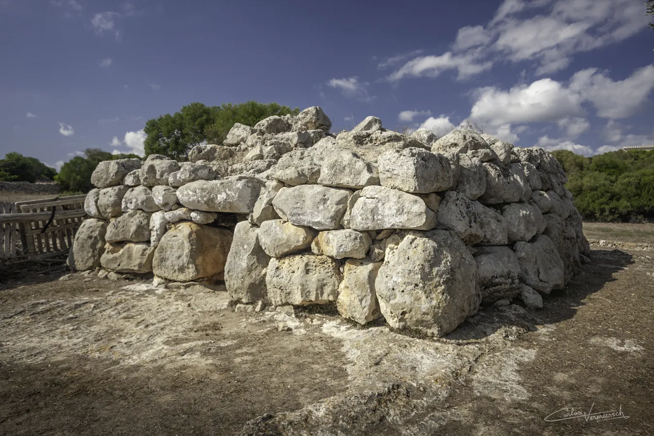
Eventually, the Bronze Age arrived during the early 2nd millennium BC, and again this indicates contact with the continent, since tin needed to be added to copper in order to create bronze, and tin does not exist on the islands. Around this time, the building techniques had become more elaborate, and the first navetiform structures started to appear. Burials were made in reformed dolmens, in natural caves, or in newly excavated caves in the rock. Some of these caves were remarkably complex, not even the caves of the Talaiotic period would achieve this level of perfection.
Notable structures
Hypogaea
Hypogaea (singular hypogaeum), from Greek ὑπό (hypó, "under") and γαῖα (gaîa, "earth"), are artificial caves which served as underground tombs during the early Bronze Age. Most of them have been plundered since antiquity, and reused during the Talaiotic period as a water reservoir. They can be rounded, elongated, or possess additional lateral cavities, antechambers, stairs, etc.
Navetiforms
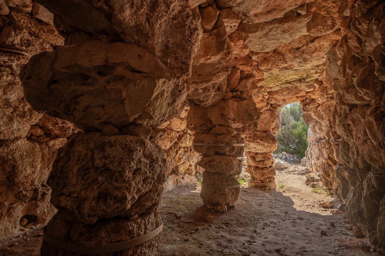
During the late Bronze Age, the natives of the Balearic Islands developed navetiforms, called like that due to the similarities they present to navetas. Navetiforms are apsidal in shape, roughly resembling an elongated horseshoe, and usually have a wooden ceiling reinforced with mortar, supported by several polylithic pillars. Although in two cases in Minorca, these structures are topped with stones instead, like the surprisingly complete Sa Cova des Moro. Excavations have revealed that they had fireplaces, and evidence has been found that some of these structures might have even had a second floor.
Early and late navetas
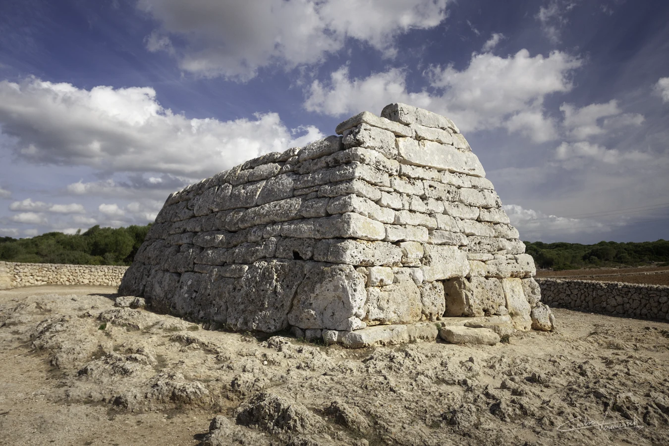
Navetas are exclusive to Minorca, and are the most famous ancient buildings of the island. They're cyclopean burial chambers that appeared in the early and middle Bronze Age. Navetas evolved from elaborate dolmens, but lost many typical traits that characterize their ancestral design. The oval structure of dolmens was adopted in the design of early navetas, like those at Biniac-L'Argentina, and afterwards it was transformed into a an elongated apsidal plan in late navetas, acquiring a shape that resembles the hull of a ship, like those at Rafal Rubí. No early navetas are well enough preserved to assess whether they had a second floor, but they probably didn't, as opposed to late navetas, that in turn did have an upper and a lower chamber. Pre-Talaiotic navetas still have a clear link to dolmens: a perforated slab at the entrance. This rectangular hole allowed to enter the structure. The borders of the hole have a distinguishable recess which was used to accomodate a closing stone. The perforated slab likely symbolized the entrance to the world of the dead, and only very few were allowed in.
Sites
Talaiotic Culture
(1400—123 BC)
The Talaiotic Culture occupies the period that stretches from the building of the first talaiots up to the arrival of history, when the Roman Republic conquered the Balearic Islands. The Talaiotic Culture is considered to belong to protohistory, not prehistory, due to the fact that despite no writing had developed, written references about it have been found in classical cultures. If it weren't for the lack of writing, the Talaiotic Culture of Minorca could be considered a civilization, possessing numerous and large buildings with social, defensive and religious purposes, all of them built with a larger monumentality than those of Majorca.
The Talaiotic Period can be further subdivided into the following periods:
Proto-Talaiotic Period (1400—1000 BC): Many features of the subsequent Talaiotic Culture began to appear. The population clustered into towns. The navetiforms were dismantled to use the building materials in newer buildings, like dwellings.
Talaiotic Ia (1400—1150 BC): Navetas, first talaiots.
Talaiotic Ib (1150—1000 BC): Walls.
Talaiotic Period (1000—450 BC): The Talaiotic Culture reaches its zenith during the 1st half of the 1st millenium BC, but falls in a crisis during the middle 1st millennium BC.
Talaiotic II (1000—800 BC): Large talaiots and walls.
Talaiotic III (800—450 BC): Hypostyles, circles and taulas.
Post-Talaiotic Period (450—123 BC): The wars that erupted between Rome and Carthage forcibly dragged the Balearic Islands into the post-Talaiotic Period.
Talaiotic IV: Carthaginian influence and Roman conquest.
Proto-Talaiotic & Talaiotic Periods
(1400-450 BC)

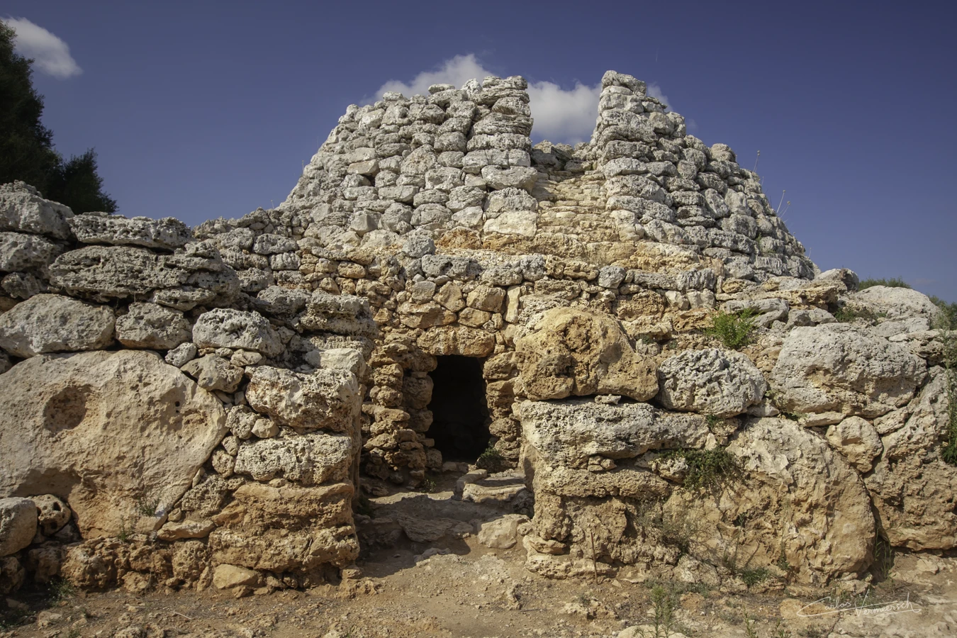
In the end of the 2nd millennium, during the proto-Talaiotic period, a crisis hits the entire society, possibly due to the impoverishment of the soils, cultivated by burning the wooded areas without the necessary knowledge on how to regenerate them, such as plowing. This led to the expansion of farming. The society gradually evolved from independent families to one with hierarchies, where clan chiefs order the construction of monuments that required a great effort on behalf of the community, such as step towers. This would eventually give rise to the Talaiotic Culture, when the first differences appeared between Minorca and Majorca.
At the beginning of the 1ˢᵗ millennium BC, the Talaiotic Culture flourished and reached its zenith. The step towers that had appeared earlier gave way to a humongous amount of talaiots, more than 500 of them distributed on Minorca and Majorca. Over time, the newer settlements began to take advantage of strategic places to take dominion over a territory, and often, these talaiots were built on borders between villages. Evidently, some of these settlements ended up protected by walls that incorporated talaiots as defensive towers. The walls were built with very large and heavy rocks, without the use of any mortar (cyclopean masonry). The funerary traditions were very varied. In Minorca, extensive necropoleis were built in natural caves or excavated in the walls of ravines, like Cala Morell.
The Pityuses (Ibiza and Formentera) had remained uninhabited until this point. But at the beginning of the Iron Age, in the 8th century BC, these islands were settled by a thalassocratic nation: Phoenicia. These seafarers spread across the Mediterranean Sea between 1500 and 300 BC to colonize or trade with distant regions, like the mining city Tarsis, of the kingdom of Tartessos in southern Iberia. The Phoenicians called Minorca "Nura", that derives from nur, meaning "fire". Because when their ships sailed near the island, they could see bonfires shine from the top of the talaiots. In 654 BC, the Phoenicians founded the city of ībošim (𐤀𐤉𐤁𐤔𐤌, ʾybšm, "islands of Beš"), modern Ibiza, becoming the center of the western Mediterranean trade due to its privileged strategic position.
The golden age of the Talaiotic Period came to an end with another crisis around the middle 1st millennium BC, during the transition from the Talaiotic Culture to the post-talaiotic Culture. It is possible that during this obscure period, the enigmatic taulas appeared, built in the previously existing Talaiotic sanctuaries. Around 600-500 BC, most talaiots had fallen into disuse and vast areas of villages were burnt and abandoned.
Notable structures
Talaiots
Talaiots are undoubtedly one of the most emblematic monuments of the Balearic Islands, so much so that they gave name to the Talaiotic Culture. Additionally, more than 500 talaiots cover the landscape of Minorca and Majorca. Minorcan talaiots are usually more monumental than Majorcan ones, perhaps indicating a better organized society. Talaiots were circular on both islands, or elliptic on Minorca and square in Majorca. Moreover, Majorcan talaiots always have an internal chamber, as opposed to Minorcan talaiots, which can be both hollow, like Ses Bigues de Mata, or completely solid, such as Torelló 1.
Secondary sources or antiquarian works (John Armstrong, The History of the Island of Minorca; Wernsdorf, De antiquitatibus Balearicis exercitatio; Dameto, History of the Balearic Kindom) mention the passage by Diodorus Siculus where he describes the ancient Balearians raising a heap of stones over their dead.
ἴδιον δέ τι ποιοῦσι καὶ παντελῶς ἐξηλλαγμένον περὶ τὰς τῶν τετελευτηκότων ταφάς: συγκόψαντες γὰρ ξύλοις τὰ μέλη τοῦ σώματος εἰς ἀγγεῖον ἐμβάλλουσι καὶ λίθους δαψιλεῖς ἐπιτιθέασιν. Translation: They also have a peculiar and entirely different custom concerning the burial of the deceased: after cutting the limbs of the body with pieces of wood, they place them in a vessel and pile upon it a heap of stones. — Diodorus Siculus, § 5.18.1
John Armstrong claimed that these tumuli consist of large unhewn stones, and are surrounded by a fence of flat stones set up on end (orthostats), and a spiral path on the outside that leads to the summit of the mound (such as the ones in talaiot Torelló 1 at Torellonet Vell, or the western talaiot of Cornia Nou). These tumuli are likely the structures today known as talaiots.
Diodorus Siculus informs us, that the Balearians heaped Stones over the Graves of their Dead: But as we have no great Number of theſe Monuments in the Iſlands, I ſuppose we are to underſtand, that this Honour was done to the Remains of ſome eminent Perſonages among the Natives, and not that they were ever the common Burying Places (...) And thus, theſe Heaps ſerved (...) to perpetuate the Memory of eminent Perſons (...) But I think it is plain, that theſe Piles were erected as Monuments, (...) yet it is obvious, from ſeveral Circumſtances, that they had a ſecondary View in the Labour and Expence which they beſtowed on them. They are ſeated on an Eminence, and ſo diſperſed at proper Diſtances throughout the Country; from whence I have been apt to ſuſpect, that theſe Repoſitories of the illuſtrious Dead (...) were uſed by the old Inhabitants as Speculæ, or Watch-Mounts, to diſcover the Approaches of an Enemy at a Diſtance, and by proper Signals to warn the Natives of their impending Danger; by which means they had Leiſure to conſider whether they were ſtrong enough to encounter the Invader in the Field, or to provide for their Safety by retiring with their Families into the Criptæ, or Caves, cut every where in the ſolid Rock, in great Numbers, all over the Iſland. (...) There was a great deal of Propriety in placing the Altars near theſe Speculæ (...) for the holy Perſons (...) could pitch upon no Spot ſo ſuitable to their Purpoſe as that from whence their Danger was diſcovered (...) As I ſuppoſe the whole Area to have been ſet apart for religious Uſes, the Fence of upright Stones ſerved to ſecure it from the unhallowed Tread of Man and Beaſt. — John Armstrong, The History of the Island of Minorca, pp. 217-220 - 1756
Therefore, John Armstrong proposed that the main function of raising tumuli over their dead was to mark the tombs of prominent and important figures in society, while defending their secondary function as places for lookout and communication, given that from their tops one can see other settlements. This theory is strengthened by the fact that talaiots are not generally placed at the periphery of settlements near its walls, but are often given a central position and located near the taula sanctuary, such as at Trepucó, Torre d'en Galmés and Talatí de Dalt.
Late navetas
The appearance of late navetas pre-dates the Talaiotic Period, but were still used well into this period. The best example is the perfectly preserved Naveta des Tudons. This Talaiotic naveta is clearly distinguishable from pre-Talaiotic navetas: it was built with dry ashlar masonry, using finely dressed rectangular stones, and the entrance, composed by two monolithic pillars supporting a lintel, which used to hold a perforated slab which is now lost. The "heap of stones" that were mentioned by Diodorus might instead correspond navetas, which are known to have been burial chambers.
Taula sanctuaries
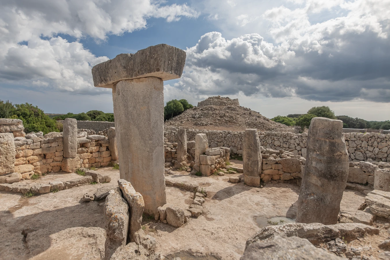
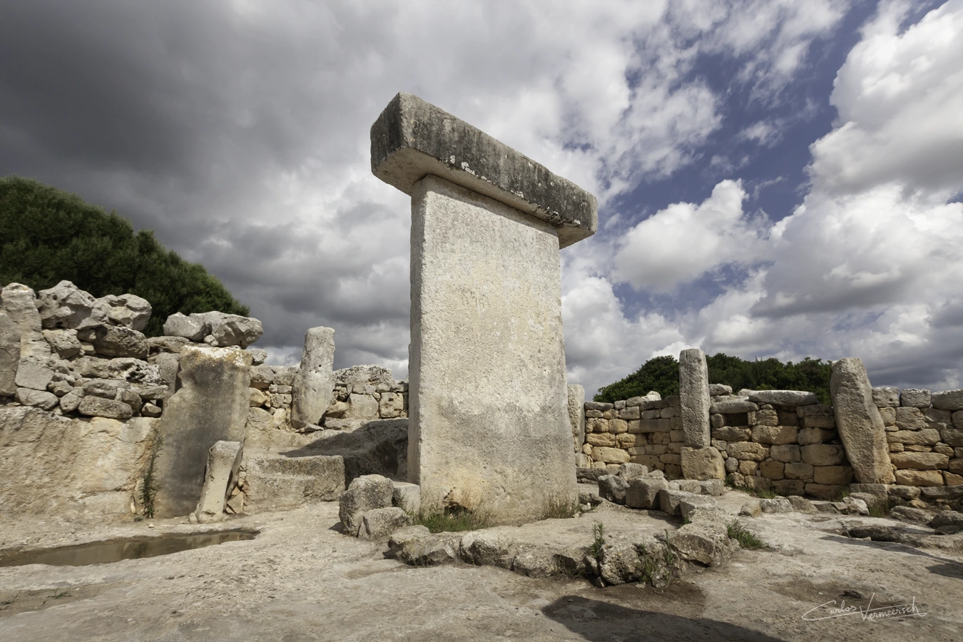
Minorca has yet another type of exclusive structure, called taula, composed of a support stone, which may have a ridge on the back, topped by a capstone which often has a recess for the support stone to fit in. These enclosures appear to have been the most important religious elements of Talayotic settlements. Taulas have been found in most Minorcan villages, but the taula and sanctuary of Torralba d'en Salord are exceptionally well preserved. Taulas are found inside a precinct that is horseshoe-shaped, called sanctuary. Taulas are exclusive to Minorca, but their sanctuaries are also found in Majorca. The sanctuary has an enclosing wall, called apse, of cyclopean masonry, with one or two entrances in the concave façade. The entrance consists of a slab on the ground called threshold, monolithic lateral pillars, and a lintel. 11 embedded columns are located at the periphery, radiating around the taula, one of which is wider, called taula-like embedded column, and a 12th freestanding column located at the left side of the taula (if one faces the entrance from the interior). The taula stands in the middle of the sanctuary, and is composed of the pillar and the capital, and can reach heights of 5 m. The base of the taula is aligned with much lower stones called flanks. Taula sanctuaries had 2 ritual fireplaces, one in front of the taula, and a second one at the left corner of the sanctuary, against the apse. Some are of the opinion that the precinct that encloses the taula was covered by a ceiling, and that the taula itself was a pillar to support it. However, most authors now believe that the sanctuary was not covered, and others claim it was only partially covered.
The purpose of taulas is unknown, however, since taulas and their sanctuaries are often found to be pointing south, they have long been seen as astronomical observatories, that were used to create calendars and predict the arrival of seasons. However, the natives did not extensively practice agriculture, only farming, and calendars are not essential, and therefore the astronomical theory is not fundamented. Moreover, taulas are mostly found pointing towards the sea.
One of the earliest theories about the function of the Taulas was that they were used as places for defleshing corpses, also known as excarnation, as argued by Juan Ramis in his 1818 work. Its capstone would serve as a raised platform to expose a corpse to carrion birds, like vultures, to deflesh it before burial. An example of this practice is found in Zoroastrianism, where their dead were gathered into a circular raised structure called daxmeh (دَخمِه) or tower of silence (بُرجِ خاموشان, borǰ xāmušān), in order to avoid contamination of the soil and other natural elements by the decomposing dead bodies, since death is equated with evil in this dualistic religion. In fact, it is known from Diodorus Siculus (§ 5.18.1) that the ancient Balearians dismembered their dead with wooden tools, which is not too dissimilar from the practice of removing the flesh and organs from a corpse before burial. However, excavations carried out in different enclosures did not provide any evidence to support this hypothesis, which does not appear in more recent publications and is currently rejected.
Additionally, animal sacrifices occurred within taula sanctuaries, as indicated by signs of liturgical banquets, although the documented bone remains predominantly comprise less nutritionally valuable parts. This led to another more general theory being proposed, which suggests that the taula served as an emblem of a deity to whom animal sacrifices were consecrated, with the taula having functioned as a tribal protector and fulfilled various roles.
Within this perspective, a specific hypothesis suggests that taulas were related to a form of taurolatry (bull-worship). The T-shaped morphology of taulas resembles a stylized depiction of a bull’s head. The discovery of the small bull figurine from Torralba d'en Salord and the significant discoveries of the Costitx bulls within the sanctuary of Predio de Son Corró in Majorca could lend support to this hypothesis. What does seem certain is that some form of bull cult existed in the Balearic Islands.
Some researchers suggest that the taulas could have been influenced by Punic culture, who claim that the taula itself is a baetyl, from Greek βαίτυλος (baítylos), itself from Semitic beṯ-el (bytʾl, "house of god"). This theory is supported by the materials documented in several enclosures, such as female-headed incense burners—representing deities like Tanit and Demeter, found at sites including Torralba d'en Salord, Biniparratx Petit and Sa Torreta de Tramuntana; various bronze figurines—including the bull and horse from Torralba, associated with Baal and Astarte; the inscriptions from Son Catlar; and others.
An Egyptian bronze figurine of Imhotep, frequently associated to curative practices, has been found near the taula of Torre d'en Galmés, which suggests the taulas may have been part of an ancient healing cult.
One of the most recent studies on taula enclosures proposes that their structure parallels that of late Talayotic houses. According to this hypothesis, the position of the taula within the enclosure corresponds to the location of the entrance door leading to the northern room in houses. This room is the most important in the dwellings, and its door often has monumental features. Thus, the taula would symbolically represent a doorway, with the vertical slab representing the opening and the horizontal stone representing the lintel.
Taulas are often found near talaiots, a proximity that may provide insight into their function. John Armstrong, In The History of the Island of Minorca from 1756 (pp. 217-220), John Armstrong equated the talaiots (or speculae, as he called them) with the heaps of stones placed over the dead by the Balearians that were mentioned by Diodorus Siculus (§ 5.18.1), and argued that talaiots served both as markers for the tombs of the most prominent figures and as watch-mounts, and were therefore ideal points for priests to fulfill their religious duties since that is where danger was spotted from.
In any case, whatever the taula might symbolize, it has two companions: the freestanding column to its left, connected to the taula by a flank, and the taula-like column to its right.
Sites
Post-Talaiotic Period & Carthaginian Influence
(450—123 BC)
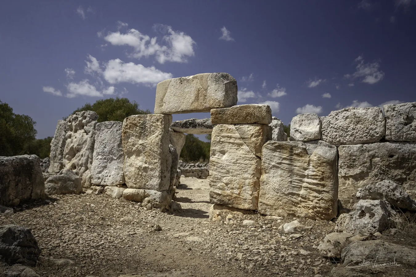
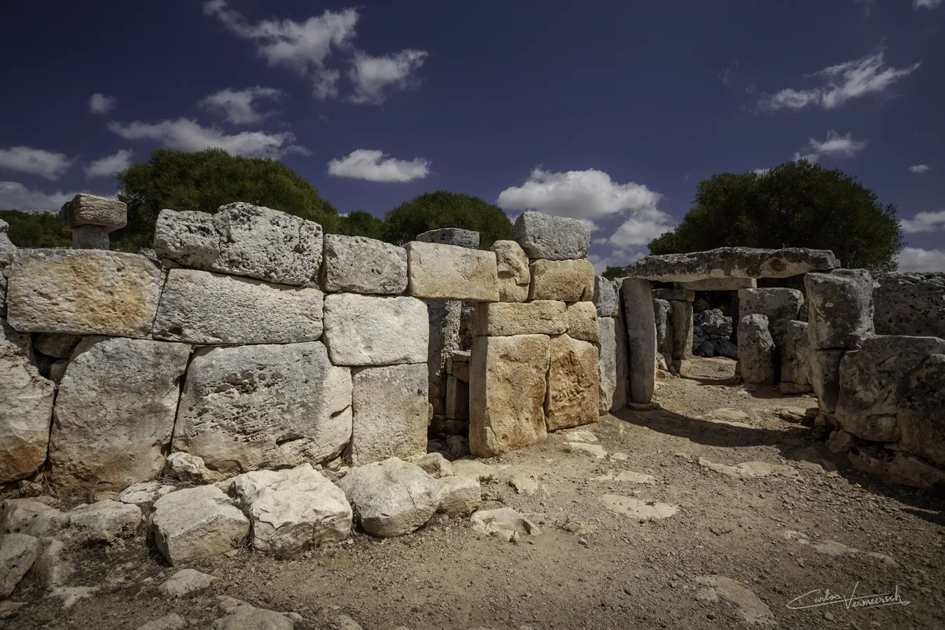
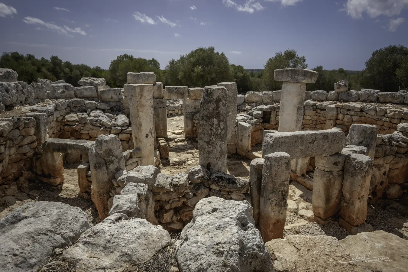
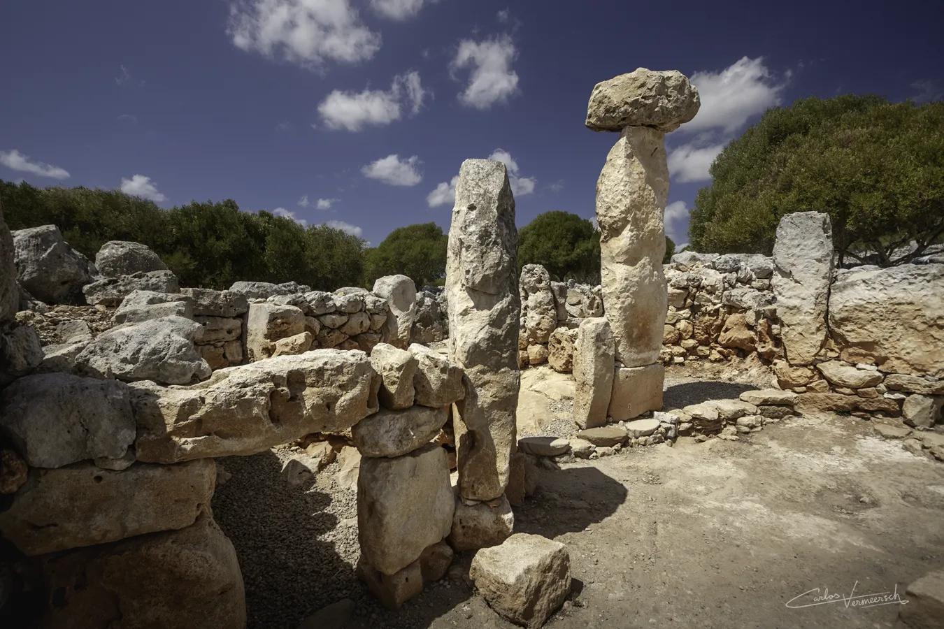
In the middle of the 1ˢᵗ millennium BC, the native culture of Minorca underwent significant changes driven by the increasing hierarchy of Talayotic society and the growing influence of colonial powers vying for control over the western Mediterranean. During this period, the construction of talayots ceased, and these monumental structures remained only as relics of the past, serving possibly as symbolic landmarks within the landscape.
With the following description by Hecataeus from ca. 500 BC, as recounted by Stephanus Byzantinus, prehistory in Minorca and Majorca came to an end, and history would properly begin:
Μήλουσα, νῆσος κατὰ Ἴβηρας. Ἑκαταῖος Εὐρώπῃ. τὸ ἐθνικὸν Μηλουσαῖος. Translation: Mḗlousa (Minorca), island near the Iberians. Hecataeus [is referring to] Europe. The ethnic [group] is Melousian. — Hecataeus of Miletus (500 BC), apud Stephanum Byzantinum, Ethnica, § M450.17 - 6ᵗʰ century AD
Κρομύουσα, νῆσος Ἰβηρίας. Ἑκαταῖος Εὐρώπῃ. τὸ ἐθνικὸν Κρομυούσιος. Translation: Kromýousa (Majorca), island of Iberia. Hecataeus [is referring to] Europe. The ethnic [group] is Kromyousian. — Hecataeus of Miletus (500 BC), apud Stephanum Byzantinum, Ethnica, § K386.12 - 6ᵗʰ century AD
This era is marked by the introduction of iron metallurgy and the the addition of Hellenistic rectangular towers and bastions built with small and medium sized horizontal ashlars to pre-existing walls around certain settlements (such as Son Catlar), coinciding with a surge in imported goods, particularly wine amphorae and everyday tableware from the Punic colony of Ibiza. Wine became a prominent product in the islands, which is a notable occurrence since it is an imported element. The abundance of amphorae within taula sanctuaries, particularly of the Punic-Ebusitan type, suggests its significance in ceremonial practices, adapted by the Talayotic Balearians for religious use.
τῶν δὲ πρὸς τὴν τροφὴν γεννημάτων οἶνον μὲν ὁλοσχερῶς οὐ φέρουσι: διὸ καὶ πάντες εἰσὶν ὑπερβολῇ πρὸς τὸν οἶνον εὐκατάφοροι, διὰ τὸ σπανίζειν παρ᾽ αὐτοῖς Translation: but as for their food products they raise no wine whatsoever; consequently the inhabitants are one and all exceedingly addicted to indulgence in wine because of the scarcity of it among them — Diodorus Siculus, § 5.17
The houses, called “circles”, achieve great perfection. They are usually built around a central patio, with many large monoliths in its interior, and are often chained together with other houses.
Notable structures
Circles
The Talaiotic house, also known as "circle" due to its shape, is the characteristic type of dwelling from the late Talaiotic period, unique to Minorca, documented from 600-500 BC (second Iron Age). This cyclopean construction is characterized by its circular plan—although some may have a more quadrangular shape.
Talaiotic circles are composed of a living area or habitat and a front patio (enclosed courtyard). A porticoed entrance leads to the interior of the front patio. This courtyard can sometimes have a piriform silo and a structure containing a hearth for roasting and smoking foodstuffs.
Access from the front patio to the living area is usually from the southern side through an entrance-corridor. This interspace usually contains two niches on each side of indeterminate function. The corridor then leads to the central patio, or atrium, which had a secondary function as an impluvium. In this central patio, there is usually a circular cooking hearth for preparing food, and in some cases, a small silo or cistern intended for water collection from the rooftops of the different rooms. The central patio served as a distributor to the various rooms of the building. It is bordered by five pillars, the spaces between them granted access to the different rooms. To the west, there are typically two rooms that could serve for the storage or production of different materials (grain mill storage, food storage areas, etc.). The eastern zone presents the most varied morphology within the archaeological record, but generally features two adjacent rooms that could be bedrooms. The northern room is the largest one, and is accessed through a somewhat monumental lintelled door, which appears to be the resting room of the inhabitants. Within this room, a higher structure is sometimes present, and in some circles, a kind of brazier has also been documented. Due to the pleasant climate enjoyed on the island for most of the year, we see that much of the daily activity took place in the central patio, leaving the various rooms for rest and storage.
The walls of the living area are double-faced (different on each side); on the outside, a first row of flat stones rests on the bedrock, forming a base or foundation upon which a second row of large vertical slabs is placed, followed by rows of smaller stones up to the ceiling. On the inner side, the wall is constructed with medium-sized stones arranged in horizontal lines. Between these two walls, there is a series of embedded pillars that, along with those located around the courtyard, could be part of the covering for the rooms. The roof of the habitat was likely formed by a framework of wooden beams that would rest on the various pillars, and above them, there would be a covering of clay and stones topped with a layer of vegetation.
Circles achieve great perfection during the post-Talaiotic Period, for example at the village of Torre d'en Galmés.
Sites
The Punic Wars
Main article: The Balearic Islands in the Punic Wars
Background
Carthage, founded in 814 BC by Phoenician settlers from Tyre, rose to prominence as eastern Phoenician cities fell under foreign domination. In the 9th–7th centuries BC, Tyre and other city-states became Assyrian vassals, paying tribute and supporting military campaigns. This weakened their independence and encouraged the integration of western colonies into the orbit of Carthage, the most powerful and independent Phoenician settlement.
Carthage grew by focusing on trade rather than territorial conquest, paying Libyans for land access and protecting trade routes. As Greek settlers returned to the western Mediterranean after 638 BC, Carthage led the Phoenician resistance, especially against the Phocaean Greeks, who founded rival colonies like Massalia (600 BC) and others in Iberia and Corsica.
In 546 BC, Cyrus the Great of Persia conquered Phocaea, causing its population to flee westward and intensify their colonial presence, particularly in Corsica. Earlier, around 539 BC, Cyrus had also incorporated Phoenicia into the Persian Empire, turning cities like Tyre and Sidon into semi-autonomous vassals contributing ships to Persian campaigns. Though initially beneficial, this eroded the traditional monarchies and brought the region firmly under Persian control. Tyre’s weakened state further enabled Carthage’s rise.
The growing Phocaean presence in the western Mediterranean alarmed Carthage and its Etruscan allies, leading to the decisive Battle of Alalia (537 BC), where they forced the Greeks to abandon Corsica despite heavy losses. This cemented Carthage's dominance in the western Mediterranean. Soon after, it incorporated key colonies in Sicily and Sardinia, and signed a treaty with Rome in 509 BC that recognized Carthage’s control over these areas and established spheres of commercial influence.
Carthage’s maritime empire emphasized commerce, diplomacy, and naval power over land conquest. It traded extensively—acquiring raw materials like gold, salt, ivory, and tin from Africa and Iberia, while exporting goods like pottery, luxury items, and spices. Merchants pioneered auctions, built warehouses, and integrated distant markets, including northern Europe, Arabia, and India.
After Alexander the Great’s conquest of Phoenicia in 332 BC, which included the brutal siege of Tyre, Phoenician influence waned, and Carthage became fully autonomous and dominant. By the 3rd century BC, it controlled a vast network of colonies and client states, surpassing the Roman Republic in reach and prosperity.
Strategically important islands like Sardinia, Corsica, and the Balearics supported Carthage with resources, harbours, and mercenaries like the Balearic slingers. These islands played dual economic and military roles, critical in Carthage’s ability to sustain prolonged conflicts, including the Punic Wars (264–146 BC) against Rome. Though ultimately defeated, Carthage had shaped the ancient Mediterranean through its commercial and naval prowess.
The Balearians in the Punic Wars
In 654 BC, the Phoenicians founded Ībošim (modern-day Ibiza) on the Pityusic Islands, integrating them into the eastern Phoenician sphere of influence. As Phoenician power declined under Assyrian, Persian, and Macedonian conquests, these islands shifted into Carthage’s control—the most powerful remaining Phoenician colony. With natural harbors, a key position between Italy and Iberia, and strong martial traditions, the islands became vital to Carthage’s naval dominance.
The Balearians, the inhabitants of the Gymnesian Islands, were first mentioned in Carthaginian military campaigns by the mid-4th century BC, notably in the Second Sicilian War (410–404 BC), and later in major battles such as Agrigento (406 BC), Ecnomus (310 BC), and during the Second Punic War at Cannae (216 BC), Numistro (210 BC), and Baecula (208 BC). From the 6th century BC, Carthage regularly employed mercenaries, particularly Iberian infantry and Balearic slingers, a practice formalized during King Hanno the Navigator’s reign (from 480 BC). In 205 BC, Ibiza aided Mago Barca, Hannibal’s brother, who took refuge in Minorca and, according to tradition, founded Mago.
Balearic slingers were elite mercenaries due to their exceptional range and precision, surpassing that of archers. From childhood, Gymnesian youths were trained in slinging, making it an institutionalized and lethal martial art. Initially recruited voluntarily, Balearic participation became more coercive near the end of the Punic Wars, with forced conscription—especially on Minorca—until Carthage’s destruction in 146 BC.
The First Punic War (264–241 BC)
Carthage and Rome maintained peaceful relations from their first treaty in 509 BC, reaffirmed in 348 and 306 BC, and cooperated against Pyrrhus in 279 BC. Tensions escalated when both powers intervened in Messana in 264 BC, triggering the First Punic War—a struggle primarily over Sicily but extending across the western Mediterranean, including strategic regions like the Balearic Islands.
Carthage relied heavily on naval strength and auxiliary troops, particularly Balearic slingers. Rome, initially inexperienced at sea, adapted quickly, securing key victories. The siege and capture of Agrigentum (262 BC) marked Rome’s first major engagement outside Italy. At Mylae (260 BC), Rome’s naval victory, enabled by the corvus boarding device, shifted the maritime balance.
Rome expanded the war to Corsica (259 BC) and raided Malta (257 BC), though the latter remained under Carthaginian control. At the massive Battle of Cape Ecnomus (256 BC), Rome defeated a larger Carthaginian fleet, enabling an invasion of North Africa. After taking Aspis and winning at Adys, consul Regulus demanded harsh terms, which Carthage rejected.
Carthage then regrouped under Spartan general Xanthippus, who decisively defeated Regulus at the Battle of the Bagradas River (255 BC), capturing him. Despite Roman setbacks, they ultimately triumphed at the Battle of the Aegates Islands (241 BC). The Treaty of Lutatius forced Carthage to surrender Sicily—Rome’s first province—cede nearby islands, release prisoners, and pay a crippling indemnity, marking Rome’s rise as a dominant naval power and shifting Mediterranean hegemony.
The Interbellum (241–218 BC)
After the 23-year First Punic War, Carthage, weakened and financially drained, could not pay its mercenaries, leading to a mutiny. This internal conflict, the Mercenary War (241–238 BC), saw 70,000 rebels besiege Carthage and destabilize its control in Africa. Although Rome initially upheld the 241 BC Treaty of Lutatius and even aided Carthage, it later changed course. When Sardinian garrisons mutinied and sought Roman protection, Rome, despite earlier refusals, launched an expedition and demanded Carthage cede Sardinia and Corsica with an additional 1,200-talent indemnity. Though these demands violated the original treaty, Carthage, still recovering, complied in 238 BC. Polybius called Rome’s actions “contrary to all justice.”
Hamilcar Barca crushed the rebellion in Africa, boosting the Barcid family’s prestige. Rome consolidated its new possessions as the province of Sardinia et Corsica by 227 BC—one of its first overseas provinces. These islands served as a buffer for Italy but remained resistant to Roman rule, sparking decades of rebellion, especially among Sardinian tribes like the Ilienses and Balares.
To recover Carthage’s losses, Hamilcar launched an Iberian campaign in 237 BC, aiming to build a new Carthaginian empire. He founded Qart Hadasht (“New Carthage”) and expanded inland, using Iberia’s wealth to fund Carthage’s revival and indemnities. His son Hannibal, sworn on Baal Hammon’s altar to never ally with Rome, joined the campaign.
Meanwhile, Carthage reinforced its hold on Malta and the Pityusic and Gymnesian Islands for strategic and military value. Rome, concerned by Carthaginian growth, signed a treaty with Hasdrubal the Fair in 226 BC, limiting Carthaginian expansion north of the Ebro River. When Hannibal attacked Saguntum—a Roman ally south of the Ebro—the Second Punic War began.
The Second Punic War (218–201 BC)
Before the Second Punic War, Carthage controlled parts of Iberia and the Balearic and Pityusic Islands through commerce and influence. In 218 BC, a Carthaginian force garrisoned Malta and launched naval raids on Sicily, but Roman forces intercepted and defeated them at the Battle of Lilybaeum. The Romans then captured Malta, including its commander Hamilcar Gisgo, and incorporated the island as a Foederata Civitas, although Punic influence remained strong for centuries.
In the same year, Hannibal famously crossed the Alps with war elephants—only a few survived, including the notable Surus—and defeated the Romans in major battles at Trebia, Lake Trasimene, and Cannae. At Cannae, Titus Livy notes Hannibal deployed Balearic slingers and other light infantry at dawn. Rome responded with the cautious Fabian strategy to avoid direct confrontations.
In 215 BC, Hasdrubal the Bald attempted to take Sardinia, but his fleet was wrecked in the Balearics, delaying his campaign and leading to his defeat and capture. Livy recounts the storm and the damage to Hasdrubal’s fleet (§23.34), and notes the Romans narrowly avoided losing the war without timely reinforcements (§23.40).
Following Malta's annexation and Sardinia’s failed reconquest, Rome controlled all major Western Mediterranean islands except the Balearics and Pityusics. This weakened Carthage’s naval dominance and opened the region to Roman trade.
In Iberia, Rome, led by Gnaeus and Publius Scipio, gained ground after the Battle of Cissa (218 BC) and repelled Hasdrubal Barca at Dertosa (215 BC), but both brothers were later killed in 211 BC. In 210 BC, Scipio Africanus arrived, captured Carthago Nova (209 BC), and won the Battle of Baecula (208 BC) against Hasdrubal Barca, who retreated but later crossed into Italy.
Livy describes (§21.18) that Hasdrubal used Balearic and African light troops during Baecula. Afterward, Hasdrubal Gisgo, Mago, and Hasdrubal Barca coordinated plans: Mago went to the Balearics to hire mercenaries, Hasdrubal Gisgo marched to Lusitania, and Hasdrubal Barca moved to Italy. Livy notes (§27.20) that Mago gathered funds and sailed to the Balearics to recruit auxiliary forces.
Mago later attempted to return to Gades but was refused, prompting him to winter in Minorca, where he recruited 2,000 Balearic slingers for Hannibal. Livy (28.37) details how the hostile major island repelled Mago’s fleet with slings, while the smaller island welcomed him and provided reinforcements.
In 205 BC, Mago sailed to Liguria, captured Genoa, and held northern Italy for three years before being recalled to Carthage. Wounded, he died at sea in 202 BC. Meanwhile, Scipio had defeated Carthaginian forces in Africa and captured their ally Syphax.
In 206 BC, the decisive Battle of Ilipa saw Scipio outmaneuver Hasdrubal Gisgo and Mago using a reversed deployment strategy. Livy (28.15) describes how the untrained Balearic and Spanish troops collapsed under the Roman assault. Over 48,500 Carthaginians were killed or captured, ending Carthaginian rule in Iberia.
Mago then attempted to retake Carthago Nova but failed, and after being rejected by Gades (which had defected to Rome), he fled to Minorca to raise troops. These slingers were highly valued by Hannibal and were protected as elite troops throughout the campaign.
Rome's victories culminated in the arrival of Hannibal back in Carthage after 16 years in Italy. Livy (30.30–31) describes Hannibal and Scipio's only meeting before Zama. Hannibal praised Scipio and proposed peace, admitting Carthage’s losses and offering to surrender overseas territories. Scipio, however, accused Hannibal of bad faith, rejected the terms, and issued harsher demands, including a war indemnity. He concluded: “If you consider this unacceptable, then prepare for war as you have been unable to endure peace.” Nonetheless, despite Scipio offered peace, under these harsher terms, Hannibal refused—possibly expecting better conditions or still believing he could achieve victory.
As a result, negotiations failed, and the two generals clashed at the Battle of Zama in 202 BC. With the crucial support of Masinissa’s Numidian cavalry, Scipio outmaneuvered Hannibal. The battle resulted in 20,000 Carthaginian deaths and 20,000 prisoners. The subsequent peace treaty forced Carthage to surrender its fleet except for ten ships, relinquish all overseas territories, pay an indemnity of 10,000 talents of silver over 50 years, and refrain from waging war without Roman approval.
This period, following Scipio’s campaigns in Iberia and Africa, likely saw modifications to pre-existing fortifications in the Gymnesian Islands due to the islands’ rising strategic importance. On Minorca, Cyclopean walls from the Talaiotic period (1000–450 BC), built with unhewn orthostats, were preserved and reinforced with rectangular towers influenced by Punic, Hellenistic, or Roman styles, constructed with ashlars. These architectural changes reflect the region’s shifting status from Carthaginian control to a contested zone as Rome expanded in Iberia. The Battle of Zama ended the Second Punic War and accelerated the incorporation and gradual Romanization of both the Gymnesian and Pityusic Islands.
The Third Punic War (149–146 BC)
By 151 BC, Carthage had repaid its war indemnity and was economically thriving, though militarily weak. Despite the lack of threat, hostility toward Carthage persisted in the Roman Senate, fueled by figures like Cato the Elder, who famously ended his speeches with Carthago delenda est (“Carthage must be destroyed”). Rome grew increasingly suspicious of Carthage’s recovery and its breach of treaty obligations, especially after Carthage, without Roman consent, launched a failed military campaign against Numidia following repeated incursions by King Masinissa. This violation gave Rome a pretext to act.
In 149 BC, a Roman force landed near Carthage. Despite Carthage’s attempts to appease Rome by surrendering weapons, a siege began. Early Roman efforts failed, but the arrival of Scipio Aemilianus in 147 BC revitalized the campaign. Appointed consul despite his age due to popularity and military success, Scipio intensified the siege, cutting off supplies and blocking the harbor. Although Carthaginian forces under Hasdrubal mounted a strong defense—including a surprise naval attack—the Romans steadily gained ground. In 146 BC, after six days of brutal fighting, the city was destroyed, 50,000 survivors were enslaved, and Carthage was razed.
Rome then annexed the territory, forming the province of Africa with Utica as its capital. The site of Carthage was cursed and left uninhabited until its later Roman reconstruction. The city's destruction removed a key rival and cemented Roman dominance in the Mediterranean. Though the conflict occurred in North Africa, the Pityusic and Gymnesian Islands—once tightly linked to Carthage's military and economic system—began falling under Roman attention by the late 2nd century BC as Rome worked to erase remaining Carthaginian influence.
Roman Era
(123 BC—468 AD)


The Roman Conquest of the Balearic Islands (123–121 BC)
The Roman conquest of the Balearic Islands, led by Consul Quintus Caecilius Metellus between 123 and 121 BC, was the culmination of years of failed attempts to bring these strategically positioned islands under Roman control. Following the Punic Wars, Rome had tried on multiple occasions to subdue Majorca, but met with no success—largely due to the islands’ rugged terrain, skilled native defenders, and persistent piracy supported by regional instability.
Having been previously ignored by Rome, the islands became a problem for Mediterranean dominance, as their lack of Roman military control led to an infestation of pirates that affected the distribution of Italic products to the westernmost regions of the Mediterranean coasts. The origins of these pirates are unknown, or whether they were the same native inhabitants of the Balearics, the Talayotics; represented by the figure of the Balearic slinger, so well-known throughout the Mediterranean, who played a crucial role in the Punic Wars between Rome and Carthage as a mercenary in the Carthaginian army. Some ancient scholars describe this issue, such as Strabo:
κατὰ μέγεθος μὲν οὖν πολὺ τῆς μείζονος ἀπολείπεται, κατὰ δὲ τὴν ἀρετὴν οὐδὲν αὐτῆς χείρων ἐστίν: ἄμφω γὰρ εὐδαίμονες καὶ εὐλίμενοι, χοιραδώδεις δὲ κατὰ τὰ στόματα, ὥστε δεῖν προσοχῆς τοῖς εἰσπλέουσι. διὰ δὲ τὴν ἀρετὴν τῶν τόπων καὶ οἱ κατοικοῦντες εἰρηναῖοι, καθάπερ καὶ οἱ κατὰ τὴν Ἔβουσον. κακούργων δέ τινων ὀλίγων κοινωνίας συστησαμένων πρὸς τοὺς ἐν τοῖς πελάγεσι λῃστάς, διεβλήθησαν ἅπαντες, καὶ διέβη Μέτελλος ἐπ᾽ αὐτοὺς ὁ Βαλιαρικὸς προσαγορευθείς, ὅστις καὶ τὰς πόλεις ἔκτισε. διὰ δὲ τὴν αὐτὴν ἀρετὴν ἐπιβουλευόμενοι, καίπερ εἰρηναῖοι ὄντες, ὅμως σφενδονῆται ἄριστοι λέγονται: καὶ τοῦτ᾽ ἤσκησαν, ὥς φασι, διαφερόντως ἐξ ὅτου Φοίνικες κατέσχον τὰς νήσους. Translation: (...) in size it (the smaller island) is far surpassed by the larger island, but in excellence it is by no means inferior, for both of them are very fertile, and furnished with harbours. (...) The fertility of these places (the Balearic Islands) inclines the inhabitants to peace, as also the people of Ebusus. But certain malefactors, though few in number, having associated with the pirates in those seas, they all got a bad name, and Metellus, surnamed Balearicus, marched against them. He it was who built the cities. But owing to the great fertility of the country, these people have always had enemies plotting against them. Although naturally disposed to peace, they bear the reputation of being most excellent slingers, which art they have been proficient in since the time that the Phoenicians possessed the islands. — Strabo, Geographia, § 3.5.1
Although piracy was cited as the official reason for the annexation of the Balearic Islands, it may have merely served as a convenient pretext. Several underlying motivations likely influenced the Roman decision: the strategic value of the islands for founding new cities and colonies in fertile lands ideal for agriculture; the presence of the skilled Balearic slingers, who could be recruited as mercenaries for the Roman army; the opportunity to secure key maritime trade routes and thereby strengthen control over the western Mediterranean; and the personal ambitions tied to power, prestige, and glory—particularly for members of the Roman aristocracy like the Metellus family, who sought to assert their dominance over political rivals.
In light of these considerations, in 123 BC, Metellus, serving alongside Titus Quinctus Flaminius, was finally entrusted by the Roman Senate with command of a formal campaign against the pirates who had made the Balearics their stronghold. The largest of the islands, Majorca, boasted two excellent natural harbors, making it a haven for pirates fleeing Roman crackdowns in Transalpine Gaul (126 BC) and Sardinia (125 BC). With nowhere else to go in the western Mediterranean, these groups—including Phoenician-connected privateers from Ebusus (modern Ibiza)—sought refuge among the Balearic Islands, where they were often joined by local tribesmen, particularly the renowned Balearic slingers.
Metellus carefully planned his campaign, as he was aware of the islanders' formidable skill with slings—proven during the Punic Wars as recounted by Livy (History of Rome, § 28.37). Therefore, Quintus ordered his ships to be covered with hides during disembarkation, forming a kind of tent under which the soldiers could take shelter from incoming projectiles and thus manage to land on the island. Once ashore, however, it proved difficult to locate the inhabitants, as they still lived in a primitive manner in caves—in the Serra de Na Burguesa, Calvià, 45 caves have been recorded, some of which were used as shelters and sources of water.
διόπερ ὁ Μέτελλος προσπλέων πρὸς τὰς νήσους δέρρεις ἔτεινεν ὑπὲρ τῶν καταστρωμάτων σκέπην πρὸς τὰς σφενδόνας. Translation: On this account Metellus, when he was approaching the islands, spread pelts over the decks as a shelter from the slings. — Strabo, Geographia, § 3.5.1
Although the conquest lasted two years and included significant resistance from tribal communities, it was ultimately not a major military challenge for Rome’s disciplined forces. Some battles were fierce, and there are records of massacres and the destruction of native sanctuaries at Son Carrió, Son Favar, and Roca Rotja. Nonetheless, by 121 BC, Metellus had decisively subdued the islands of Majorca and Minorca, earning him the honorific Balearicus in recognition of his success and a Triumph in Rome.
The campaign's outcome was not only strategic but also economic. The islands were fertile and rich in resources—such as salt—and were ideally positioned to secure maritime routes between Hispania and Italy. To secure Roman control, Metellus settled around 3,000 Romans in two newly founded colonies on Majorca: Palma (modern Palma de Mallorca) and Pollentia (modern Alcúdia), the latter becoming the provincial capital. While some sources suggest these settlers originally came from mainland Italy—possibly from the Velina tribe in the Picenum region—it is more likely they were a mix of Roman veterans from the campaigns in Hispania and local Roman-Iberian hybridae.
εἰσήγαγε δὲ ἐποίκους τρισχιλίους τῶν ἐκ τῆς Ἰβηρίας Ῥωμαίων. Translation: He introduced into the country 3,000 Roman colonists from Spain. — Strabo, Geographia, § 3.5.1
In Minorca, Roman administration reused existing Punic-influenced urban centers such as Mago (Mahón) and Iamona (Ciutadella), adapting them into military outposts (castella). Additionally, a military port, Sanisera (at Sanitja), was established on the northern coast to deter future pirate encroachments. Due to their historic ties with Phoenician powers, Minorcan cities were subjected to a harsher fiscal regime, designated as civitates stipendiariae—tributary cities with limited rights.
Despite the violence of conquest, the process of Romanization proceeded relatively quickly, though driven more by commerce than by culture. While Roman religious practices and funerary customs gradually replaced indigenous ones—such as burials in natural or artificial caves—the ethnic and cultural base of the Talayotic and post-Talayotic societies endured. The Balearic slingers, however, were rapidly integrated into the Roman military. Remarkably, within just over a decade of the conquest, they were already fighting in North Africa alongside Roman forces, maintaining their legacy as one of the islands’ most valued contributions to the empire.
The Balearic Islands were officially incorporated into the province of Hispania Citerior. Later, under Augustus' administrative reforms in 13 BC, they were reassigned to the Provincia Tarraconensis. Still, the insular nature of the archipelago posed challenges for Roman governance—especially in winter months, when harsh sea conditions often turned the Mediterranean into a mare clausum (an unnavigable sea), isolating the islands from the rest of the empire.
Following the Roman conquest of the Balearic Islands, historical records again refer to the slingers, who were now part of the Roman army. Gaius Sallustius notes the presence of Balearic slingers among Roman forces engaged in Numidia against King Jugurtha between 111 and 105 BCE. Additionally, Julius Caesar mentions Balearic slingers as participants in the Gallic Wars around 56 BC, serving as light infantry auxiliaries, fighting alongside other elite units like Numidian cavalry and Cretan archers.
In the 4ᵗʰ century AD, the emperor Theodosius merged the Pityuses (Ibiza and Formentera) with the Balearic Islands (Majorca and Minorca), creating the Roman province of Hispania Balearica.
The Balearics remained under Roman control until their capture by the Vandals in 455 AD. Their conquest and integration marked a turning point, not only in Rome’s control of western Mediterranean trade routes but also in the blending of indigenous, Punic, and Roman identities across the islands.
Roman settlements on the islands
Majorca
According to Pliny, there were five important settlements on Majorca:
Baliares (...) maior (...) oppida habet civium Romanorum Palmam et Pollentiam, Latina Guium et Tucim, et foederatum Bocchorum fuit. Translation: Balearics (...) the greater [island] has the following towns; Palma and Pollentia, enjoying the rights of Roman citizens, Guium and Tucis, with Latin rights: Bocchor, a federate town, is no longer in existence. — Pliny, Historia Naturalis, § 3.77
Palma
Palma was mentioned by Strabo (Geographia, III, 5, 1) alongside Pollentia, as one of the two cities on the larger island, or Baliar Maior (Mallorca). The exact location of the city of Palma has been debated. Although it is traditionally identified with the provincial Roman ruins beneath the historic center of Palma de Mallorca, there is no absolute certainty. According to Strabo, the city was founded by Q. Caecilius Metellus, known as Baleárico, around 123 BCE. Pliny (Historia Naturalis, III, 77) also names both cities as oppida with Roman rights, and Pomponius Mela (Chorographia, II, 109) calls them colonies. Ptolemy (Geographia, II, 5) lists Palma as a settlement of the Gymnesiae. Very little is known about the Roman city due to later constructions built on top of it and the lack of a comprehensive research plan. Urban excavations have uncovered Republican-era materials, dated between 70–60 BC and later, but as with Pollentia, no structures have yet been found dating to the alleged founding period. This has led some authors to propose an origin as a military encampment or castellum, with later development during the Sertorian period, when it may have acquired the status of colony. The Imperial city would have been located roughly beneath the current Almudayna district, an elevated platform like an acropolis, surrounded by the sea and a wall dated to the 2ⁿᵈ century AD. In this area, remains of a monumental building and inscriptions indicating its public nature were found. Beneath the cathedral, a building with a room containing a hypocaust was also excavated and has been interpreted as possible baths. There is speculation about a port and walled area in the lower part of the city, near which a theater may have existed—though evidence is scarce, apart from its favorable location and the discovery of a monumental inscription likely related to such a structure. Based on remains found in various excavations, the city's layout appears to have been orthogonal, with an approximate size of 6 hectares. Through epigraphy, we know that the populations of Palma and Pollentia acquired the privileged status of municipium, and their inhabitants were enrolled in the Velina tribe, one of the 35 Roman tribes and the only case of its kind in all Hispania. According to Mª J. Pena, a significant number of the colonists likely came from the Picenum region, where there were two cities named Palma and Pollentia belonging to the Velina tribe. Following the same author, it is probable that Q. Caecilius Metellus himself came from this Italic region, which would explain why he brought settlers to the islands. Territorial studies show that both the lands of Palma and Pollentia were organized into centuriae to distribute among the colonists. The city remained occupied through Late Antiquity, with materials indicating the presence of Vandals and Byzantines. However, it was less important and less populated than Pollentia and gradually declined until the arrival of the Muslims, who re-named it as Madīnah Mayūrqah (مدينة ميورقة, Anselm Turmeda, a.k.a. ʿAbd Allāh at-Tarǧumān). The toponym Palma has traditionally been linked to militaristic and triumphalist meanings—Palma referring to the “palms of victory”.
Pollentia
Pollentia was mentioned by Strabo (Geographia, III, 5, 1) as one of the two cities on the larger island, or Gymnesiae, identified with the present-day city of Alcúdia, Majorca. According to this author, it was founded by Q. Caecilius Metellus, known as Balearicus, around 123 BC. Pliny (Historia Naturalis, III, 77) refers to Palma and Pollentia as oppida with Roman rights, and Pomponius Mela (Chorographia, II, 109) and Ptolemy (Geographia, II, 5) describe them as colonies. The city was located on an easily defensible isthmus, at the opposite end from Civitas Bocchoritana, near an earlier Talayotic settlement. During the Republican period, it retained its privileged status as a city with Roman rights, and according to some authors, it experienced significant growth during the Sertorian era, a time marked by general Romanization and development of these cities. The oldest remains are located in the residential zone of Sa Portella, specifically on Calle Porticada. Earlier excavations identified three phases: a Talayotic settlement with archaeological materials ranging from the 4ᵗʰ century BC until the Roman conquest; a second phase in which this earlier phase was filled in; and a third phase with Roman structures dating to 70 BC. In the forum area, a Capitoline temple, two smaller temples, tabernae, a shrine, a colonnaded street, and more have been documented. Before the forum’s construction, the land was leveled to make space for the square and buildings, which demonstrates a clear intention to create an ex novo city with an orthogonal layout. From the forum, the streets and insulae were arranged, forming blocks and residential neighborhoods, all of geometric design and uniform orientation. Material evidence dates this construction phase to between 70–60 BC. The city experienced a period of growth under Augustus and achieved municipal status during the Flavian era, as confirmed by epigraphy (res publica Poll(entina/entinorum)). The forum structures remained in use, undergoing repairs throughout the Empire, though some new buildings—such as the two temples or commercial and artisan buildings—were added. The city also had a theater, built in the 1ˢᵗ century AD, a bath complex known only from photos of early excavations, and an aqueduct. Various necropolises have been excavated since early times, located both within the city and to its north and south. These contain both inhumation in graves and cremation in urns, and date from the 2ⁿᵈ to 1ˢᵗ centuries BC. Epigraphic evidence shows that the populations of Palma and Pollentia were enrolled in the Velina tribe, one of Rome’s 35 tribes and the only such case in all Hispania. According to Mª J. Pena, a good number of the colonists likely came from the Picenum region, where there were two cities in the Velina tribe called Palma and Pollentia. Following this same author, it is probable that Q. Caecilius Metellus came from this Italic region, which would explain why he brought settlers to the islands. At the end of the 3ʳᵈ century AD, a significant burn layer has been identified in different parts of the forum and residential neighborhoods. From this same period comes the construction of a defensive wall, which reused earlier structures. The connection between these events and any specific historical episode remains unknown. The city continued to be inhabited during Late Antiquity, following the Vandal conquest in 455 and the Byzantine reconquest in 534. In the 5ᵗʰ century, a wall was built enclosing the northernmost area of the old forum. The toponym of Pollentia, like that of Palma, has been associated with militaristic and triumphalist meanings—Pollentia being associated with "superiority" and "power." The suffix -entia appears in several Latin place names, such as Valentia, Faventia, Potentia, etc.
Bocchor
Bocchor was located in Baliar Maior and identified with Pedret del Bóquer at Port de Pollença, at the western end of the Bay of Alcúdia. The only literary reference to this city comes from Pliny (Historia Naturalis, III, 77), who mentions it among the island’s cities and notes its former status as a federated city. Two inscriptions also attest to its existence, though in both cases only the gentilic form appears: civitas Bocchoritana and senatus populusque Bocchoritanus. No source provides the city’s name in the nominative form, a fact that has led to a long-standing debate and various proposed reconstructions of the name: Bochorus, Bochorum, Bochoris, Bochori, or Bocchor, since Pliny’s reference seems to refer to an ethnic designation. It is possible that even by Pliny’s time, doubts already existed about the city’s actual name, as it may have ceased to exist as an independent political entity around 6 AD. According to E. García Riaza, the most likely toponym is Bocchor, from which Bocchoritanum would derive to refer to its inhabitants—similar formations are known from North African examples. This name would also have evolved into the modern toponym Bóquer. No architectural remains of the city have been located, but it is believed to lie beneath the Pedret del Bóquer, in the vicinity where the two preserved inscriptions were found.
Minorca
Pliny also names the three important settlements on Minorca: Iamo/Iamna, Sanisera, and Mago/Magon:
Baliares (...) minor (...) civitates habet Iamonem, Saniseram, Magonem Translation: Balearics (...) the lesser [island] (...) contains the states of Iamo, Sanisera, and Mago. — Pliny, Historia Naturalis, § 3.77
Iamo
The first settlement Pliny mentioned has been identified with the present-day town of Ciutadella, and its toponym is thought to mean "wet meadow" or "humid place." The site shows evidence of Talayotic and Punic occupation, the latter related to the establishment of the port city of Iamo. The strategic conditions of the port likely sparked interest in its control, which probably led to the construction of a fortification—hence the name used by Pomponius Mela (Chorographia, II, 109), who refers to it as "castella Iamna." Pliny (Historia Naturalis, III, 77) refers to it as a "civitas", and Ptolemy (Geographia, II, 5) includes it among the cities of the Gymnesiae. Originally, it would have been a peregrine or stipendiary city within the province of Tarraconensis. From the Flavian period onward, it became a municipium, as confirmed by epigraphic evidence found in Barcino (Barcelona), and Iamo then became known as Iamna, and officially Municipium Flavium Iamnontanum. Materials and structures from the Imperial and Late periods have been documented in various parts of Ciutadella.
Mago
As for Mago, it was a port of Punic origin identified with the town of Maó-Mahón. The site was chosen by General Mago in 206–205 BC to spend the winter with his troops after being expelled from Balearis Maior (Majorca). According to some authors, based on Livy's description that mentions the reuse of structures, the site had a prior Phoenician settlement. Urban archaeology has confirmed at least the presence of a Talayotic settlement with an occupation phase between the 3ʳᵈ and 1ˢᵗ centuries BC. The city of Mago reached a high degree of Romanization during the early Imperial period and became a municipium in the Flavian era, officially named Municipium Flavium Magontanum. Classical sources provide information about the site starting from the 1ˢᵗ century AD, from which it can be inferred that it was a peregrine or stipendiary city. Pliny (Natural History, III, 77) lists Mago among the oppida and cities with Roman rights. Pomponius Mela (Chorographia, II, 109) refers to both Iamna and Mago as castella. Urban archaeological excavations have uncovered structures and street layouts of the Roman city, which during the 1ˢᵗ–3ʳᵈ centuries AD was likely located in the area of Es Pont des Castell, where most inscriptions attesting to its Flavian municipium status have been found. Associated with the city, necropoleis have been documented on both sides of the access roads, and epigraphic finds in Alaior have confirmed the existence of a road connecting Mago with the city of Iamna, apparently repaired during the reign of Trajan. The site was also referred to as Portus Magonis or Portus Magontanus. Bishop Severus, in the early 5ᵗʰ century AD, described the location of the city on the eastern part of the island, an area where much of the epigraphic evidence has been found beneath the current urban center. The oldest toponymic traditions offer Mago as a Punic noun. According to some authors, it may derive from the proper name Magon (Phoenician: 𐤌𐤂𐤍, mgn), though others suggest it could stem from the Semitic nouns maghen or maghonah, meaning "refuge, shelter, protection"—qualities that indeed align with the sheltered nature of Mahón’s port.
Sanisera
Sanisera was only mentioned by Pliny (Natural History, III, 77) in Baliar Minor. The site has been identified since the 18ᵗʰ century with El Port de Sanitja in Es Mercadal, and the origins of the settlement lie in a Talayotic core located on the eastern side of the ravine. Above this, a small Republican-era settlement was established. On the western side of the bay, an additional settlement has been documented, showing occupation from the 1ˢᵗ century BC to the 7ᵗʰ century AD. The port of Sanisera was one of the best and most strategic on the entire northern coast and remained active throughout Late Antiquity, with frequent contacts with Africa. The settlement also persisted at least until the 7ᵗʰ century AD, as confirmed by archaeological material.
During the two-year Roman conquest of the Balearic Islands, a military garrison was established at the port of Sanisera. Positioned at the southern end of the harbor on its highest ground—approximately 15 to 20 meters above sea level—this site was chosen by Metellus for its strategic value. He constructed a fortified settlement that included defensive towers along the coast to monitor incoming vessels and maintain control over much of the island’s northern shoreline. Even after the conquest concluded, the military camp at Sanisera remained in use until around 45 BC. Archaeological evidence, including spatial reorganizations and pottery dating from the time of the conquest through the mid-1st century BC, attests to its continued occupation. Throughout its active years, the Sanisera garrison may have played a role in various conflicts on the Iberian Peninsula, including rebellions and civil wars in which the Balearic forces—particularly the renowned slingers—participated decisively. One such episode occurred during the Sertorian Wars (83–72 BC), a conflict between the forces of Sulla and Sertorius in Hispania. Evidence suggests the camp remained active during this period and into a later phase of occupation. Eventually, the site was abandoned, likely around 45 BC, coinciding with Caesar’s reorganization of the Roman military. This marked the beginning of a relatively peaceful era for both the Balearic Islands and much of the peninsula, during which the Romanization of the local populations likely took root.
The strategic significance of the military camp at Sanisera lay not only in its location but also in the composition of its forces, which included native Balearic slingers. These troops served as auxiliae alongside Roman soldiers—such as hastati (lancers) and principes (infantry)—within a fortified camp that featured barracks and various functional spaces dedicated to daily military life. These included areas for tending wounds sustained during training, tailoring uniforms, repairing boots, melting lead to make sling bullets, and maintaining equipment. Surrounded by a defensive trench system, this was a space where Roman and native troops lived, trained, and interacted closely. The Balearic slingers were likely trained at the camp to familiarize them with Roman military tactics and to assimilate aspects of Roman customs and lifestyle. Thanks to the camp’s position at a port, supplies such as food, wine, and other goods were regularly delivered by sea. Vessels carrying amphorae filled with items like fish, wheat, wine, and olive oil followed established maritime routes across the western Mediterranean—from Ostia to Minorca. This steady flow of provisions brought with it a variety of people involved in military logistics, including sailors and merchants. Some of these individuals may have begun to settle near the camp. The presence of a garrison also attracted others—craftsmen, tavern workers, members of the local population, and veteran soldiers—who may have established a civilian settlement in the vicinity. Over time, this mix of individuals likely contributed to the growth of a small, informal community around the port of Sanisera.
Lacesse
Epigraphic material has brought to light a fourth Latin toponym of Minorca, corresponding to the most significant finding in the Talaiotic settlement of Son Catlar: two inscriptions bearing the legends LACESE (CIB 166) and LACESEN (CIB 167). LACESE appears on a prismatic stone, possibly a component of a door, found in the settlement's taula sanctuary. LACESEN, possibly an abbreviation of the genitive form or perhaps its gentilicial, was found on another in the vicinity of the current walled enclosure, which only encloses part of the ancient settlement, which extended primarily toward the east, with other extensions to the south and north, where the necropoleis and quarries were located. These inscribed prismatic stones have also been interpreted as boundary markers of the territory of Roman Iamo and a community of indigenous origin called Lacese—which might be Son Catlar itself—at an early moment of Romanization.
Sites
Sanisera
Byzantine Era
(533—707 AD)


The Vandals under Genseric conquered the Islands sometime between 461 and 468 during their war on the Roman Empire. However, in late 533 or early 534, following the Battle of Ad Decimum, Justinian I gave Belisarius the command of gaining control of the islands for the Byzantine Empire. One year later, Belisarius entrusted the conquest of the Balearic Islands to his lieutenant Apollinaris, where he became governor.
Sites
Basílica de Son Bou
Basílica des Cap des Port
Basílica des Fornàs de Torelló
Basílica de la Isla del Rey
Muslim Era
(707—1232 AD)


Byzantine Imperial power receded precipitously in the western Mediterranean after the fall of Carthage and the Exarchate of Africa to the Umayyad Caliphate in 698, and in 707 the islands submitted to the terms of an Umayyad fleet, which allowed the residents to maintain their traditions and religion as well as a high degree of autonomy. Now nominally both Byzantine and Umayyad, the de facto independent islands occupied a strategic and profitable grey area between the competing religions and kingdoms of the western Mediterranean. The prosperous islands were thoroughly sacked by the Swedish Viking King Björn Ironside and his brother Hastein during their Mediterranean raid of 859–862.
In 902, the heavy use of the islands as a pirate base provoked the Emirate of Córdoba, nominally the island's overlords, to invade and incorporate the islands into their state. However, the Cordoban Caliphate that succeeded the Emirate disintegrated in civil war in the early 11th century, breaking into smaller states called taifa. Mujahid al-Siqlabi, the ruler of the Taifa of Dénia, sent a fleet and seized control of the islands in 1015, using it as the base for subsequent expeditions to Sardinia and Pisa. In 1050, the island's governor Abd Allah ibn Aglab rebelled and established the independent Taifa of Majorca.
Sites
Castle of Santa Àgueda
Aragonese Conquest &
Catalan Colonization (1232 AD)
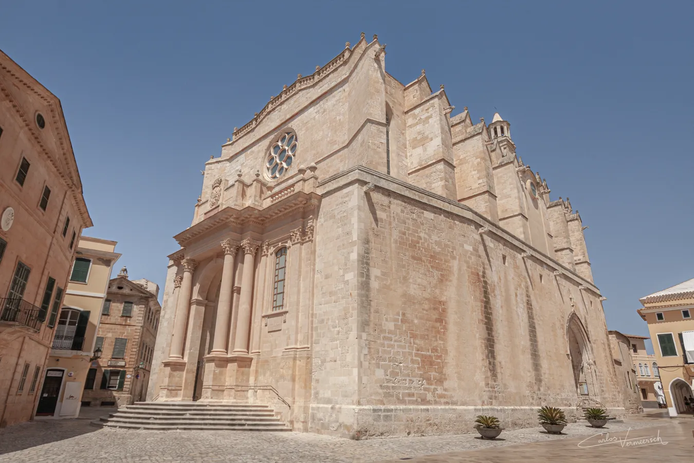
On the last day of 1229, King James I of Aragon captured Palma after a three-month siege. The rest of Majorca quickly followed. Minorca fell in 1232 and Ibiza in 1235. James died in 1276, having partitioned his domains between his sons James and Peter in his will. The will created a new Kingdom of Majorca from the Balearic islands and the mainland counties of Roussillon and Montpellier, which was left to his son James II of Majorca. However, the terms of the will specified that the new kingdom be a vassal state to the Kingdom of Aragon, which was left to his older brother Peter III.
Because the recent conquest of Sicily by Peter III the Great, Pope Martin IV declared the Aragonese Crusade against Peter and officially deposed him as king. Martin bestowed Aragon on Charles, Count of Valois, son of the French king, Philip III, and nephew of Peter III. James II joined forces with the Pope Martin IV and Philip III of France against his brother Peter III in the Aragonese Crusade, leading to a 10-year Aragonese occupation. Majorca was devastated as an independent polity. However, the crusade resulted in an Aragonese victory, and Peter's successor Alfonso III annexed Majorca, Ibiza, and Minorca in the following years.
However, the Treaty of Tarascon of 1291, that intended to end the Aragonese Crusade, officially restored Aragon to Alfonso III and lifted the ban of the church. Alfonso was obligated to pay a tribute to the church, and carry out a crusade to the Holy Land. In 1295, the Treaty of Anagni confirmed the Treaty of Tarascon and returned the islands to James II.
The tension between the kingdoms continued through the generations until James' grandson James III was killed by the invading army of Peter's grandson Peter IV at the 1349 Battle of Llucmajor. The Balearic Islands were then incorporated directly into the kingdom of Aragon.
#megalithic #megalítico #ruins #ruinas #talayotic #talayótico #talaiotic #talaiótico #talayot #talaiot #taula #naveta #navetadestudons #BalearicIslands #IslasBaleares #Balearic #Baleares #Minorca #Menorca #Majorca #Mallorca #archaeology #archeology #arqueología #history #historia #prehistory #prehistoria #protohistory #protohistoria


Comments